
Site Information for London Cromwell Road 2(UKA00370)
London Cromwell Road 2 Information
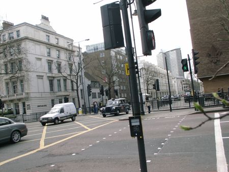
The monitoring station is within a self-contained, air conditioned housing located in the southwest corner of the front gardens of the Natural History Museum at a traffic light controlled crossroads. The nearest road, the A4 Cromwell Road is approximately 4 metres from the monitoring station. The traffic flow on Cromwell Road is approximately 53,000 vehicles per day. The manifold inlet is approximately 2 metres above roadside due to the fact that the site has sunken gardens. The surrounding area is generally open. Trees occur within 2 metres distance of the monitoring station.
UK-AIR ID: UKA00370
EU Site ID: GB0695A
Altitude (metres): 20
Environment Type: Urban Traffic
Site Location
Environment Type: Urban Traffic
Site Address: London
Government Region: Greater London
Easting/Northing: 526529, 178966
Latitude/Longitude: 51.495483, -0.178709

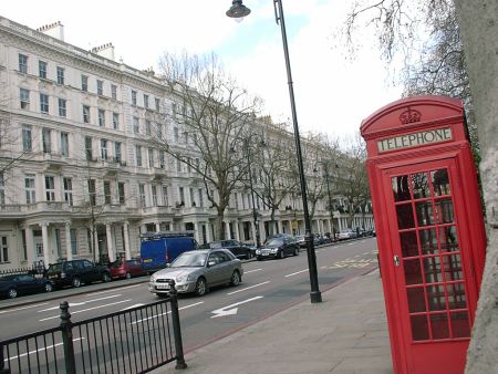


The static map below shows where the monitoring site is located.
» View this location on Google Maps (new window)
» View this monitoring site on the interactive monitoring networks map
Partners
The Partners who operate networks at this monitoring sites are shown in the table below. Clicking on the Partner name will open their website in a new window.
| Operator | Networks |
|---|---|
| National Physical Laboratory | Heavy Metals Network |
| Centre for Ecology & Hydrology | Acid Gas and Aerosol Network |
| Centre for Ecology & Hydrology | National Ammonia Monitoring Network |
Pollutants measured at this monitoring site
The pollutants measured at this monitoring site, grouped by network, are shown below. Use the links below to quickly jump to a specific network.
- Acid Gas and Aerosol Network
- Automatic Urban Monitoring Network
- Heavy Metals Network
- National Ammonia Monitoring Network
Acid Gas and Aerosol Network
| Pollutant | Start Date | End Date | Inlet Height (m) |
|---|---|---|---|
| Particulate calcium | 06/01/2006 | 01/02/2017 | 1.5 |
| Particulate chloride | 06/01/2006 | 01/02/2017 | 1.5 |
| Particulate magnesium | 06/01/2006 | 01/02/2017 | 1.5 |
| Particulate sodium | 06/01/2006 | 01/02/2017 | 1.5 |
| Particulate nitrite | 30/06/2009 | 01/02/2017 | 1.5 |
| Particulate nitrate | 06/01/2006 | 01/02/2017 | 1.5 |
| Particulate sulphate | 06/01/2006 | 01/02/2017 | 1.5 |
| Gaseous hydrochloric acid | 06/01/2006 | 05/01/2016 | 1.5 |
| Gaseous nitric acid | 06/01/2006 | 01/02/2017 | 1.5 |
| Gaseous nitrous acid | 30/06/2009 | 01/02/2017 | 1.5 |
| Gaseous sulphur dioxide | 06/01/2006 | 01/02/2017 | 1.5 |
Automatic Urban Monitoring Network
| Pollutant | Start Date | End Date | Inlet Height (m) | Hourly PM Measurement method |
|---|---|---|---|---|
| Nitric oxide | 20/05/1998 | 30/09/2012 | 2.5 | |
| Nitrogen dioxide | 20/05/1998 | 30/09/2012 | 2.5 | |
| Nitrogen oxides as nitrogen dioxide | 20/05/1998 | 30/09/2012 | 2.5 | |
| Sulphur dioxide | 20/05/1998 | 30/09/2012 | 2.5 | |
| Carbon monoxide | 20/05/1998 | 30/09/2012 | 2.5 | |
| Modelled Wind Direction | 01/08/2010 | 30/09/2012 | 10 | |
| Modelled Wind Speed | 01/08/2010 | 30/09/2012 | 10 | |
| Modelled Temperature | 01/08/2010 | 30/09/2012 | 2 |
Heavy Metals Network
| Pollutant | Start Date | End Date | Inlet Height (m) |
|---|---|---|---|
| Arsenic | 31/01/2004 | 31/12/2013 | 3.0 |
| Cadmium | 31/01/2004 | 31/12/2013 | 3.0 |
| Chromium | 31/01/2004 | 31/12/2013 | 3.0 |
| Cobalt | 01/04/2011 | 31/12/2013 | 2.0 |
| Copper | 31/01/2004 | 31/12/2013 | 3.0 |
| Iron | 31/01/2004 | 31/12/2013 | 3.0 |
| Lead | 31/01/2004 | 31/12/2013 | 3.0 |
| Manganese | 31/01/2004 | 31/12/2013 | 3.0 |
| mercury in PM10 | 31/01/2004 | 31/12/2013 | 3.0 |
| total gaseous mercury | 31/01/2004 | 31/12/2013 | 3.0 |
| Nickel | 31/01/2004 | 31/12/2013 | 3.0 |
| Platinum | 31/01/2004 | 31/12/2013 | 3.0 |
| Selenium | 01/04/2011 | 31/12/2013 | 2.0 |
| Vanadium | 31/01/2004 | 31/12/2013 | 3.0 |
| Zinc | 31/01/2004 | 31/12/2013 | 3.0 |
National Ammonia Monitoring Network
| Pollutant | Start Date | End Date | Inlet Height (m) |
|---|---|---|---|
| particulate ammonium | 30/11/1999 | 01/02/2017 | 1.5 |
| gaseous ammonia (active) | 30/11/1999 | 01/02/2017 | 1.5 |
| gaseous ammonia (passive) | 01/02/2017 | - | 1.5 |
Networks measured at this monitoring site
The listing below shows the networks that this monitoring site belongs to. You can search for sites within these networks by clicking on their name, or use the network information links to find out more about them.
| Network | Search | Further Details | Get Data |
|---|---|---|---|
| Automatic Urban and Rural Monitoring Network (AURN) | Automatic Urban and Rural Monitoring Network (AURN) | About network | Latest pollution summary Current Levels Pre-Formatted Data Files |
| Heavy Metals | Heavy Metals | About network | Metals data download page Data Selector |
| UKEAP: Acid Gases & Aerosol Network | UKEAP: Acid Gases & Aerosol Network | About network | CEH Website (External website) Data Selector |
| UKEAP: National Ammonia Monitoring Network | UKEAP: National Ammonia Monitoring Network | About network | Data Selector |