
Site Information for Bush Estate(UKA00128)
Bush Estate Information
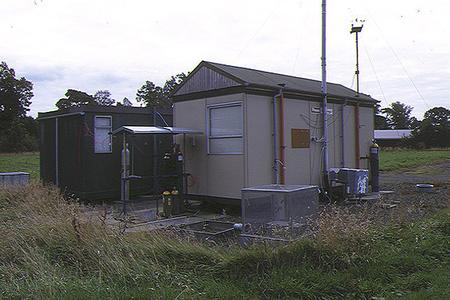
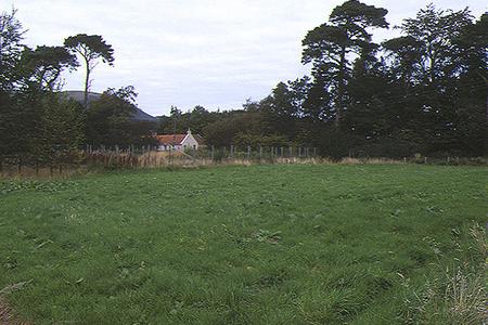
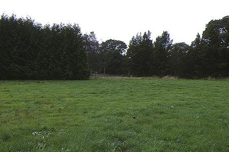
The monitoring station is located within a self-contained, air conditioned housing located within the grounds of the Institute of Terrestrial Ecology some 10 kilometres south of the centre of Edinburgh. The nearest road is a quiet rural road approximately 50 metres north of the station. The A702 is approximately 450 metres west of the site. The surrounding area is generally open with trees located within the vicinity approximately 40 metres from the monitoring station.
UK-AIR ID: UKA00128
EU Site ID: GB0033R
Altitude (metres): 180
Environment Type: Rural Background
Site Location
Environment Type: Rural Background
Site Address: Bush Estate
Government Region: Central Scotland
Easting/Northing: 324629, 663891
Latitude/Longitude: 55.862281, -3.205782
The static map below shows where the monitoring site is located.
» View this location on Google Maps (new window)
» View this monitoring site on the interactive monitoring networks map
Partners
The Partners who operate networks at this monitoring sites are shown in the table below. Clicking on the Partner name will open their website in a new window.
| Operator | Networks |
|---|---|
| Centre for Ecology & Hydrology | Acid Gas and Aerosol Network |
| Centre for Ecology & Hydrology | National Ammonia Monitoring Network |
| Bureau Veritas | Automatic Rural Monitoring Network |
Pollutants measured at this monitoring site
The pollutants measured at this monitoring site, grouped by network, are shown below. Use the links below to quickly jump to a specific network.
- Acid Gas and Aerosol Network
- Automatic Rural Monitoring Network
- National Ammonia Monitoring Network
- Other AP system network
- Weekly Rural SO2
Acid Gas and Aerosol Network
| Pollutant | Start Date | End Date | Inlet Height (m) |
|---|---|---|---|
| Particulate calcium | 03/09/1999 | - | 1.5 |
| Particulate chloride | 03/09/1999 | - | 1.5 |
| Particulate magnesium | 03/09/1999 | - | 1.5 |
| Particulate sodium | 03/09/1999 | - | 1.5 |
| Particulate nitrite | 03/09/1999 | - | 1.5 |
| Particulate nitrate | 03/09/1999 | - | 1.5 |
| Particulate sulphate | 03/09/1999 | - | 1.5 |
| Gaseous hydrochloric acid | 03/09/1999 | 05/01/2016 | 1.5 |
| Gaseous nitric acid | 03/09/1999 | - | 1.5 |
| Gaseous nitrous acid | 03/09/1999 | - | 1.5 |
| Gaseous sulphur dioxide | 03/09/1999 | - | 1.5 |
Automatic Rural Monitoring Network
| Pollutant | Start Date | End Date | Inlet Height (m) | Hourly PM Measurement method |
|---|---|---|---|---|
| Ozone | 01/04/1986 | - | 4.0 | |
| Nitric oxide | 09/10/2003 | - | 4.0 | |
| Nitrogen dioxide | 09/10/2003 | - | 4.0 | |
| Nitrogen oxides as nitrogen dioxide | 09/10/2003 | - | 4.0 | |
| Modelled Wind Direction | 01/08/2010 | - | 10 | |
| Modelled Wind Speed | 01/08/2010 | - | 10 | |
| Modelled Temperature | 01/08/2010 | - | 2 |
National Ammonia Monitoring Network
| Pollutant | Start Date | End Date | Inlet Height (m) |
|---|---|---|---|
| particulate ammonium | 01/12/1998 | - | 1.5 |
| gaseous ammonia (active) | 09/09/1996 | - | 1.5 |
| gaseous ammonia (passive) | 04/10/1997 | - | 1.5 |
| gaseous ammonia (diffusion tube) | 09/09/1996 | 31/03/2006 | 1.5 |
Other AP system network
| Pollutant | Start Date | End Date | Inlet Height (m) |
|---|---|---|---|
| Sulphur dioxide as S | 01/01/1992 | 31/12/1997 | Not available |
Weekly Rural SO2
| Pollutant | Start Date | End Date | Inlet Height (m) |
|---|---|---|---|
| Sulphur dioxide as S | 02/01/1998 | 01/01/2004 | Not available |
Networks measured at this monitoring site
The listing below shows the networks that this monitoring site belongs to. You can search for sites within these networks by clicking on their name, or use the network information links to find out more about them.
| Network | Search | Further Details | Get Data |
|---|---|---|---|
| Automatic Urban and Rural Monitoring Network (AURN) | Automatic Urban and Rural Monitoring Network (AURN) | About network | Latest pollution summary Current Levels Pre-Formatted Data Files |
| UKEAP: Acid Gases & Aerosol Network | UKEAP: Acid Gases & Aerosol Network | About network | CEH Website (External website) Data Selector |
| UKEAP: National Ammonia Monitoring Network | UKEAP: National Ammonia Monitoring Network | About network | Data Selector |
| UKEAP: Precip-Net | UKEAP: Precip-Net | About network | Data Selector |