
Site Information for Bridgwater A372 Westonzoyland(UKA01120)
Bridgwater A372 Westonzoyland Information
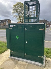
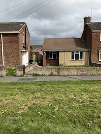
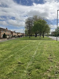
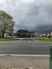
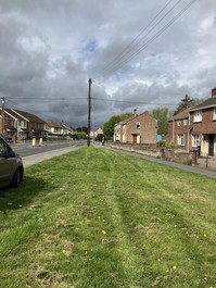
The site is locate in a green space on the north side of Westonzoyland road as it passes through a residential area.
UK-AIR ID: UKA01120
EU Site ID: GB1562A
Altitude (metres): 7
Environment Type: Urban Traffic
Site Location
Environment Type: Urban Traffic
Site Address: Land near 27 Westonzoyland Road (A372) Bridgwater TA6 4DY
Government Region: South West
Easting/Northing: 331165, 136665
Latitude/Longitude: 51.125113, -2.984988
The static map below shows where the monitoring site is located.
» View this location on Google Maps (new window)
» View this monitoring site on the interactive monitoring networks map
Partners
The Partners who operate networks at this monitoring sites are shown in the table below. Clicking on the Partner name will open their website in a new window.
| Operator | Networks |
|---|---|
| Bureau Veritas | Automatic Urban Monitoring Network |
Pollutants measured at this monitoring site
The pollutants measured at this monitoring site, grouped by network, are shown below.
Automatic Urban Monitoring Network
| Pollutant | Start Date | End Date | Inlet Height (m) | Hourly PM Measurement method |
|---|---|---|---|---|
| PM2.5 particulate matter (Hourly measured) | 24/03/2026 | - | 2 | FIDAS |
| Modelled Wind Direction | 24/03/2026 | - | 10 | |
| Modelled Wind Speed | 24/03/2026 | - | 10 | |
| Modelled Temperature | 24/03/2026 | - | 2 |
Networks measured at this monitoring site
The listing below shows the networks that this monitoring site belongs to. You can search for sites within these networks by clicking on their name, or use the network information links to find out more about them.
| Network | Search | Further Details | Get Data |
|---|---|---|---|
| Automatic Urban and Rural Monitoring Network (AURN) | Automatic Urban and Rural Monitoring Network (AURN) | About network | Latest pollution summary Current Levels Pre-Formatted Data Files |