
Site Information for Gloucester Tredworth(UKA01102)
Gloucester Tredworth Information
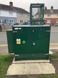
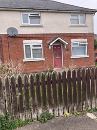
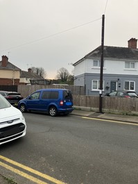
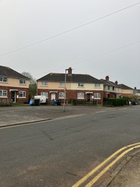
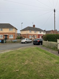
Grass area on corner of residential road in a housing estate in the Tredworth area of Gloucester.
UK-AIR ID: UKA01102
EU Site ID: GB1544A
Altitude (metres): 20
Environment Type: Urban Background
Site Location
Environment Type: Urban Background
Site Address: 2 Hartland Road Gloucester GL1 4RU
Government Region: South West
Easting/Northing: 383910, 216813
Latitude/Longitude: 51.849673, -2.234996
The static map below shows where the monitoring site is located.
» View this location on Google Maps (new window)
» View this monitoring site on the interactive monitoring networks map
Partners
The Partners who operate networks at this monitoring sites are shown in the table below. Clicking on the Partner name will open their website in a new window.
| Operator | Networks |
|---|---|
| Bureau Veritas | Automatic Urban Monitoring Network |
Pollutants measured at this monitoring site
The pollutants measured at this monitoring site, grouped by network, are shown below.
Automatic Urban Monitoring Network
| Pollutant | Start Date | End Date | Inlet Height (m) | Hourly PM Measurement method |
|---|---|---|---|---|
| PM10 particulate matter (Hourly measured) | 01/04/2025 | - | 1.8 | FIDAS |
| PM2.5 particulate matter (Hourly measured) | 01/04/2025 | - | 1.8 | FIDAS |
| Modelled Wind Direction | 01/04/2025 | - | 10 | |
| Modelled Wind Speed | 01/04/2025 | - | 10 | |
| Modelled Temperature | 01/04/2025 | - | 2 |
Networks measured at this monitoring site
The listing below shows the networks that this monitoring site belongs to. You can search for sites within these networks by clicking on their name, or use the network information links to find out more about them.
| Network | Search | Further Details | Get Data |
|---|---|---|---|
| Automatic Urban and Rural Monitoring Network (AURN) | Automatic Urban and Rural Monitoring Network (AURN) | About network | Latest pollution summary Current Levels Pre-Formatted Data Files |