
Site Information for Lincoln Canwick Road(UKA00561)
Lincoln Canwick Road Information
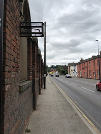
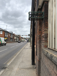
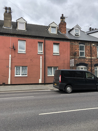
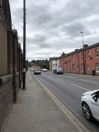
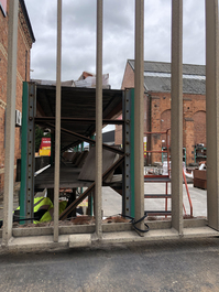
The monitoring station is located within a self contained housing within the grounds of a building supplies retailer. The station is approximately 2 metres for the A15 Canwick Road, a three lane road. The surrounding area comprises of open parkland to the NE, residential housing to the SW and light industry to the north.
UK-AIR ID: UKA00561
EU Site ID: GB1014A
Altitude (metres): 7
Environment Type: Urban Traffic
Site Location
Environment Type: Urban Traffic
Site Address: Not available
Government Region: East Midlands
Easting/Northing: 497963, 370378
Latitude/Longitude: 53.221432, -0.534204
The static map below shows where the monitoring site is located.
» View this location on Google Maps (new window)
» View this monitoring site on the interactive monitoring networks map
Partners
The Partners who operate networks at this monitoring sites are shown in the table below. Clicking on the Partner name will open their website in a new window.
| Operator | Networks |
|---|---|
| Bureau Veritas | Automatic Urban Monitoring Network |
Pollutants measured at this monitoring site
The pollutants measured at this monitoring site, grouped by network, are shown below.
Automatic Urban Monitoring Network
| Pollutant | Start Date | End Date | Inlet Height (m) | Hourly PM Measurement method |
|---|---|---|---|---|
| Nitric oxide | 27/07/2011 | - | 2.6 | |
| Nitrogen dioxide | 27/07/2011 | - | 2.6 | |
| Nitrogen oxides as nitrogen dioxide | 27/07/2011 | - | 2.6 | |
| Modelled Wind Direction | 27/07/2011 | - | 10 | |
| Modelled Wind Speed | 27/07/2011 | - | 10 | |
| Modelled Temperature | 27/07/2011 | - | 2 |
Networks measured at this monitoring site
The listing below shows the networks that this monitoring site belongs to. You can search for sites within these networks by clicking on their name, or use the network information links to find out more about them.
| Network | Search | Further Details | Get Data |
|---|---|---|---|
| Automatic Urban and Rural Monitoring Network (AURN) | Automatic Urban and Rural Monitoring Network (AURN) | About network | Latest pollution summary Current Levels Pre-Formatted Data Files |