
Site Information for Exeter Roadside(UKA00263)
Exeter Roadside Information
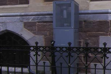
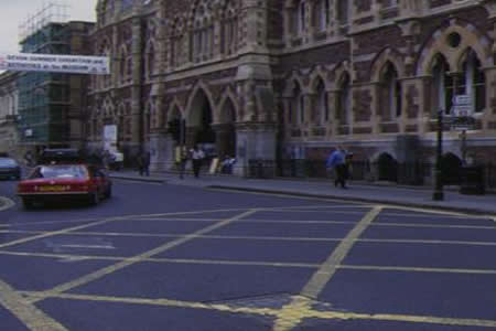
The monitoring station is within the basement of the existing museum building located at the kerbside near of a busy urban street, Queen Street. Queen Street is a single-carriageway road with high buildings on either side. The surrounding area is urban in nature and comprises of retail and business premises. The monitoring station is located approximately 2 metres from the kerb.
UK-AIR ID: UKA00263
EU Site ID: GB0640A
Altitude (metres): 43
Environment Type: Urban Traffic
Site Location
Environment Type: Urban Traffic
Site Address: Exeter
Government Region: South West
Easting/Northing: 291929, 92838
Latitude/Longitude: 50.725083, -3.532465


The static map below shows where the monitoring site is located.
» View this location on Google Maps (new window)
» View this monitoring site on the interactive monitoring networks map
Partners
The Partners who operate networks at this monitoring sites are shown in the table below. Clicking on the Partner name will open their website in a new window.
| Operator | Networks |
|---|---|
| Bureau Veritas | Automatic Urban Monitoring Network |
Pollutants measured at this monitoring site
The pollutants measured at this monitoring site, grouped by network, are shown below.
Automatic Urban Monitoring Network
| Pollutant | Start Date | End Date | Inlet Height (m) | Hourly PM Measurement method |
|---|---|---|---|---|
| Ozone | 02/07/1996 | - | 2.0 | |
| Nitric oxide | 02/07/1996 | - | 2.0 | |
| Nitrogen dioxide | 02/07/1996 | - | 2.0 | |
| Nitrogen oxides as nitrogen dioxide | 02/07/1996 | - | 2.0 | |
| Sulphur dioxide | 02/07/1996 | 30/09/2007 | 2 | |
| Carbon monoxide | 02/07/1996 | 30/09/2007 | 2 | |
| Modelled Wind Direction | 01/08/2010 | - | 10 | |
| Modelled Wind Speed | 01/08/2010 | - | 10 | |
| Modelled Temperature | 01/08/2010 | - | 2 |
Networks measured at this monitoring site
The listing below shows the networks that this monitoring site belongs to. You can search for sites within these networks by clicking on their name, or use the network information links to find out more about them.
| Network | Search | Further Details | Get Data |
|---|---|---|---|
| Automatic Urban and Rural Monitoring Network (AURN) | Automatic Urban and Rural Monitoring Network (AURN) | About network | Latest pollution summary Current Levels Pre-Formatted Data Files |