
Site Information for Glazebury(UKA00170)
Glazebury Information
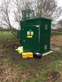
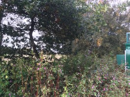
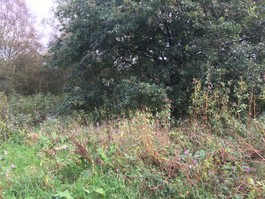
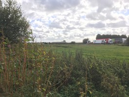
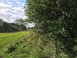
The monitoring station is within a self-contained, air conditioned housing located within the grounds of a local farm. The nearest road is access only to the grounds of the farm and is approximately 100 metres from the monitoring station. The nearest trees are at a distance of approximately 3 metres from the station.
UK-AIR ID: UKA00170
EU Site ID: GB0034R
Altitude (metres): 21
Environment Type: Rural Background
PM2.5 Targets This site is used in the assessment of the Annual Mean Concentration Target (AMCT) under the Environmental Target (Fine Particulate Matter) (England) Regulations 2023, subject to meeting the inclusion criteria on an annual basis. It is not used in the assessment of the Population Exposure Reduction Target (PERT). To find out more about how measurements are used to calculate progress towards the targets and which sites have met the inclusion criteria in different years, please see the PM2.5 target calculation page.
Site Location
Environment Type: Rural Background
Site Address: Glazebury
Government Region: North West & Merseyside
Easting/Northing: 368755, 396030
Latitude/Longitude: 53.460080, -2.472056
The static map below shows where the monitoring site is located.
» View this location on Google Maps (new window)
» View this monitoring site on the interactive monitoring networks map
Partners
The Partners who operate networks at this monitoring sites are shown in the table below. Clicking on the Partner name will open their website in a new window.
| Operator | Networks |
|---|---|
| Bureau Veritas | Automatic Rural Monitoring Network |
| National Physical Laboratory | UK Black Carbon Network |
Pollutants measured at this monitoring site
The pollutants measured at this monitoring site, grouped by network, are shown below. Use the links below to quickly jump to a specific network.
Automatic Rural Monitoring Network
| Pollutant | Start Date | End Date | Inlet Height (m) | Hourly PM Measurement method |
|---|---|---|---|---|
| Ozone | 01/04/1988 | - | 3.3 | |
| Nitric oxide | 26/01/2004 | - | 3.3 | |
| Nitrogen dioxide | 26/01/2004 | - | 3.3 | |
| Nitrogen oxides as nitrogen dioxide | 26/01/2004 | - | 3.3 | |
| PM10 particulate matter (Hourly measured) | 01/06/2022 | - | 3.3 | FIDAS |
| PM2.5 particulate matter (Hourly measured) | 01/06/2022 | - | 3.3 | FIDAS |
| Modelled Wind Direction | 01/08/2010 | - | 10 | |
| Modelled Wind Speed | 01/08/2010 | - | 10 | |
| Modelled Temperature | 01/08/2010 | - | 2 |
UK Black Carbon Network
| Pollutant | Start Date | End Date | Inlet Height (m) |
|---|---|---|---|
| Black Carbon (880nm) | 16/04/2024 | - | 3.0 |
| UV Particulate Matter (UV-BC) | 16/04/2024 | - | 3.0 |
| Infra Red Particulate matter (950nm) | 16/04/2024 | - | 3.0 |
| Red Particulate matter (660nm) | 16/04/2024 | - | 3.0 |
| Yellow Particulate matter (590nm) | 16/04/2024 | - | 3.0 |
| Green Particulate matter (520nm) | 16/04/2024 | - | 3.0 |
| Blue Particulate matter (470nm) | 16/04/2024 | - | 3.0 |
| UV Particulate Matter (370nm) | 16/04/2024 | - | 3.0 |
Networks measured at this monitoring site
The listing below shows the networks that this monitoring site belongs to. You can search for sites within these networks by clicking on their name, or use the network information links to find out more about them.
| Network | Search | Further Details | Get Data |
|---|---|---|---|
| Automatic Urban and Rural Monitoring Network (AURN) | Automatic Urban and Rural Monitoring Network (AURN) | About network | Latest pollution summary Current Levels Pre-Formatted Data Files |
| Black Carbon | Black Carbon | About network | Data Selector |