
Site Information for Mace Head(UKA00167)
Mace Head Information
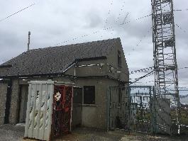
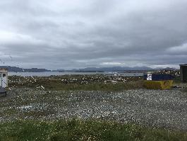
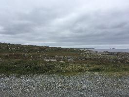
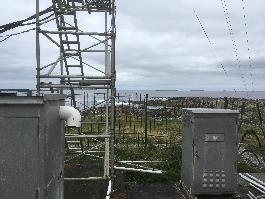
The monitoring station is located at the Mace Head Atmospheric Research Station and is approximately 100 metres from the Atlantic sea shore, 5 metres above sea level. The nearest road is a residential road approximately 400 metres to the east. The The surrounding area is rural in nature.
UK-AIR ID: UKA00167
EU Site ID: IE0031R
Altitude (metres): 15
Environment Type: Rural Background
Site Location
Environment Type: Rural Background
Site Address: Not available
Government Region: West Ireland
Easting/Northing: -125862, 410236
Latitude/Longitude: 53.326444, -9.903917
The static map below shows where the monitoring site is located.
» View this location on Google Maps (new window)
» View this monitoring site on the interactive monitoring networks map
Partners
The Partners who operate networks at this monitoring sites are shown in the table below. Clicking on the Partner name will open their website in a new window.
| Operator | Networks |
|---|---|
| University of Bristol | Automatic Hydrocarbon Monitoring Network |
| Bureau Veritas | Automatic Rural Monitoring Network |
Pollutants measured at this monitoring site
The pollutants measured at this monitoring site, grouped by network, are shown below. Use the links below to quickly jump to a specific network.
Automatic Hydrocarbon Monitoring Network
| Pollutant | Start Date | End Date | Inlet Height (m) |
|---|---|---|---|
| ethane | 01/01/2015 | - | 10 |
| propane | 01/01/2015 | - | 10 |
| iso-butane | 01/01/2015 | - | 10 |
| n-butane | 01/01/2015 | - | 10 |
| iso-pentane | 01/01/2015 | - | 10 |
| n-pentane | 01/01/2015 | - | 10 |
| benzene | 01/01/2015 | - | 10 |
Automatic Rural Monitoring Network
| Pollutant | Start Date | End Date | Inlet Height (m) | Hourly PM Measurement method |
|---|---|---|---|---|
| Ozone | 03/04/1987 | - | 10 | |
| Modelled Wind Direction | 01/08/2010 | - | 10 | |
| Modelled Wind Speed | 01/08/2010 | - | 10 | |
| Modelled Temperature | 01/08/2010 | - | 2 |
Networks measured at this monitoring site
The listing below shows the networks that this monitoring site belongs to. You can search for sites within these networks by clicking on their name, or use the network information links to find out more about them.
| Network | Search | Further Details | Get Data |
|---|---|---|---|
| Automatic Hydrocarbon Network | Automatic Hydrocarbon Network | About network | Data Selector |
| Automatic Urban and Rural Monitoring Network (AURN) | Automatic Urban and Rural Monitoring Network (AURN) | About network | Latest pollution summary Current Levels Pre-Formatted Data Files |