
Site Information for Leominster(UKA00489)
Leominster Information
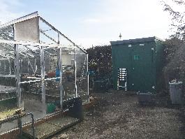
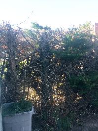
The monitoring station is located within a self contained, air conditioned housing within the school grounds of Minster College on the southern edge of the town. The nearest road is approximately 40 metres from the station, and is a quiet access road. The immediate area is open with the wider environment consisting of residential dwellings.
UK-AIR ID: UKA00489
EU Site ID: GB0861A
Altitude (metres): 75
Environment Type: Suburban Background
Site Location
Environment Type: Suburban Background
Site Address: Leominster
Government Region: West Midlands
Easting/Northing: 349761, 258410
Latitude/Longitude: 52.221593, -2.736840
The static map below shows where the monitoring site is located.
» View this location on Google Maps (new window)
» View this monitoring site on the interactive monitoring networks map
Partners
The Partners who operate networks at this monitoring sites are shown in the table below. Clicking on the Partner name will open their website in a new window.
| Operator | Networks |
|---|---|
| Bureau Veritas | Automatic Urban Monitoring Network |
Pollutants measured at this monitoring site
The pollutants measured at this monitoring site, grouped by network, are shown below.
Automatic Urban Monitoring Network
| Pollutant | Start Date | End Date | Inlet Height (m) | Hourly PM Measurement method |
|---|---|---|---|---|
| Ozone | 18/07/2005 | - | 3.3 | |
| Nitric oxide | 18/07/2005 | - | 3.3 | |
| Nitrogen dioxide | 18/07/2005 | - | 3.3 | |
| Nitrogen oxides as nitrogen dioxide | 18/07/2005 | - | 3.3 | |
| Sulphur dioxide | 06/02/2008 | 07/08/2012 | 2.0 | |
| Modelled Wind Direction | 01/08/2010 | - | 10 | |
| Modelled Wind Speed | 01/08/2010 | - | 10 | |
| Modelled Temperature | 01/08/2010 | - | 2 |
Networks measured at this monitoring site
The listing below shows the networks that this monitoring site belongs to. You can search for sites within these networks by clicking on their name, or use the network information links to find out more about them.
| Network | Search | Further Details | Get Data |
|---|---|---|---|
| Automatic Urban and Rural Monitoring Network (AURN) | Automatic Urban and Rural Monitoring Network (AURN) | About network | Latest pollution summary Current Levels Pre-Formatted Data Files |