
Site Information for Hafod-yr-ynys Roadside(UKA00596)
Please Note: This monitoring site is closed.
Hafod-yr-ynys Roadside Information
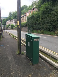
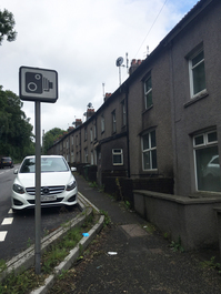
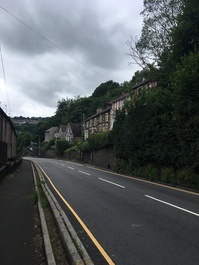
The monitoring station is within a self-contained air conditioned mobile unit along the road side of A472 -Hafod road, approximately 100m west of the junction with Gladstone Road and around 250 meters south of Swffryd's town centre. The surrounding area comprises some waste/agricultural lands (to the south), and some residential houses in the site's vicinity. Approximately 370 meters to the southwest, A472 crosses with the A467 The monitoring station is located approximately 0.5 metres from the kerb.
UK-AIR ID: UKA00596
EU Site ID: GB1038A
Altitude (metres): Not available
Environment Type: Urban Traffic
Site Location
Environment Type: Urban Traffic
Site Address: Not available
Government Region: South Wales
Easting/Northing: 321727, 198588
Latitude/Longitude: 51.680579, -3.133508
The static map below shows where the monitoring site is located.
» View this location on Google Maps (new window)
Partners
The Partners who operate networks at this monitoring sites are shown in the table below. Clicking on the Partner name will open their website in a new window.
| Operator | Networks |
|---|---|
| Bureau Veritas | Automatic Urban Monitoring Network |
Pollutants measured at this monitoring site
The pollutants measured at this monitoring site, grouped by network, are shown below. Use the links below to quickly jump to a specific network.
Automatic Urban Monitoring Network
| Pollutant | Start Date | End Date | Inlet Height (m) | Hourly PM Measurement method |
|---|---|---|---|---|
| Nitric oxide | 14/10/2014 | 15/09/2023 | 1.6 | |
| Nitrogen dioxide | 14/10/2014 | 15/09/2023 | 1.6 | |
| Nitrogen oxides as nitrogen dioxide | 14/10/2014 | 15/09/2023 | 1.6 | |
| Modelled Wind Direction | 14/10/2014 | 15/09/2023 | 10 | |
| Modelled Wind Speed | 14/10/2014 | 15/09/2023 | 10 | |
| Modelled Temperature | 14/10/2014 | 15/09/2023 | 2 |
UK Urban NO2 Network
| Pollutant | Start Date | End Date | Inlet Height (m) |
|---|---|---|---|
| Nitrogen dioxide (corrected) | 01/01/2020 | 01/01/2026 | 1.7 |
Networks measured at this monitoring site
The listing below shows the networks that this monitoring site belongs to. You can search for sites within these networks by clicking on their name, or use the network information links to find out more about them.
| Network | Search | Further Details | Get Data |
|---|---|---|---|
| Automatic Urban and Rural Monitoring Network (AURN) | Automatic Urban and Rural Monitoring Network (AURN) | About network | Latest pollution summary Current Levels Pre-Formatted Data Files |
| UK Urban NO2 Network | UK Urban NO2 Network | About network | Data Selector Network Information page |