
Site Information for Birmingham Tyburn Roadside(UKA00543)
Please Note: This monitoring site is closed.
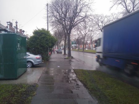
Site Observations
13/09/12 - ongoing
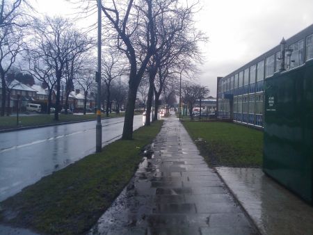
The footpath adjacent to the Tyburn Roadside site and for the whole length of Tyburn Road from on both sides is currently being replaced. This has entailed the dual carriageway being restricted to one lane in either direction from 09:30 till 16:00 each working day. (Mon -
Fri) This work has been on-going from September 3rd and has resulted in a noticeable increase in congestion.
Birmingham Tyburn Roadside Information
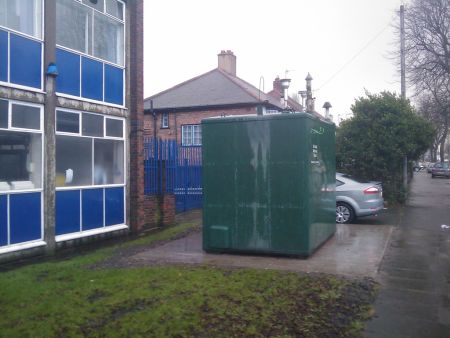
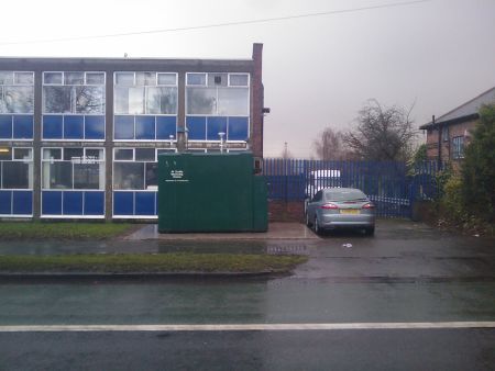
The monitoring station is within a self-contained, air-conditioned housing located on the south side of the A38 in Tyburn outside council owned offices. The site is located approximately 700 metres to the north of the M6 motorway.
UK-AIR ID: UKA00543
EU Site ID: GB0960A
Altitude (metres): 93
Environment Type: Urban Traffic
Site Location
Environment Type: Urban Traffic
Site Address: Birmingham
Government Region: West Midlands
Easting/Northing: 411576, 290492
Latitude/Longitude: 52.512194, -1.830861
The static map below shows where the monitoring site is located.
» View this location on Google Maps (new window)
Partners
The Partners who operate networks at this monitoring sites are shown in the table below. Clicking on the Partner name will open their website in a new window.
| Operator | Networks |
|---|---|
| Bureau Veritas | Automatic Urban Monitoring Network |
| Ricardo Energy & Environment | Non-Automatic Hydrocarbon Network |
| National Physical Laboratory | UK Black Carbon Network |
Pollutants measured at this monitoring site
The pollutants measured at this monitoring site, grouped by network, are shown below. Use the links below to quickly jump to a specific network.
Automatic Urban Monitoring Network
| Pollutant | Start Date | End Date | Inlet Height (m) | Hourly PM Measurement method |
|---|---|---|---|---|
| Ozone | 11/02/2009 | 07/09/2016 | 4.0 | |
| Nitric oxide | 11/02/2009 | 07/09/2016 | 4.0 | |
| Nitrogen dioxide | 11/02/2009 | 07/09/2016 | 4.0 | |
| Nitrogen oxides as nitrogen dioxide | 11/02/2009 | 07/09/2016 | 4.0 | |
| PM10 particulate matter (Hourly measured) | 11/02/2009 | 07/09/2016 | 4.0 | FDMS |
| Non-volatile PM10 (Hourly measured) | 11/02/2009 | 07/09/2016 | 4 | FDMS |
| Volatile PM10 (Hourly measured) | 11/02/2009 | 07/09/2016 | 4 | FDMS |
| PM2.5 particulate matter (Hourly measured) | 11/02/2009 | 07/09/2016 | 4.0 | FDMS |
| Non-volatile PM2.5 (Hourly measured) | 11/02/2009 | 07/09/2016 | 4 | FDMS |
| Volatile PM2.5 (Hourly measured) | 11/02/2009 | 07/09/2016 | 4 | FDMS |
| Modelled Wind Direction | 01/08/2010 | 07/09/2016 | 10 | |
| Modelled Wind Speed | 01/08/2010 | 07/09/2016 | 10 | |
| Modelled Temperature | 01/08/2010 | 07/09/2016 | 2 |
Non-Automatic Hydrocarbon Network
| Pollutant | Start Date | End Date | Inlet Height (m) |
|---|---|---|---|
| benzene | 01/09/2010 | 07/09/2016 | 4.0 |
UK Black Carbon Network
| Pollutant | Start Date | End Date | Inlet Height (m) |
|---|---|---|---|
| Black Carbon (880nm) | 12/03/2012 | 07/09/2016 | 3.0 |
| UV Particulate Matter (UV-BC) | 12/03/2012 | 07/09/2016 | 3.0 |
Networks measured at this monitoring site
The listing below shows the networks that this monitoring site belongs to. You can search for sites within these networks by clicking on their name, or use the network information links to find out more about them.
| Network | Search | Further Details | Get Data |
|---|---|---|---|
| Automatic Urban and Rural Monitoring Network (AURN) | Automatic Urban and Rural Monitoring Network (AURN) | About network | Latest pollution summary Current Levels Pre-Formatted Data Files |
| Black Carbon | Black Carbon | About network | Data Selector |
| Non-Automatic Hydrocarbon Network | Non-Automatic Hydrocarbon Network | About network | Network Information page |