
Site Information for Sandwell West Bromwich(UKA00374)
Please Note: This monitoring site is closed.
Sandwell West Bromwich Information
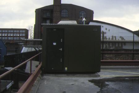
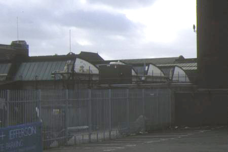
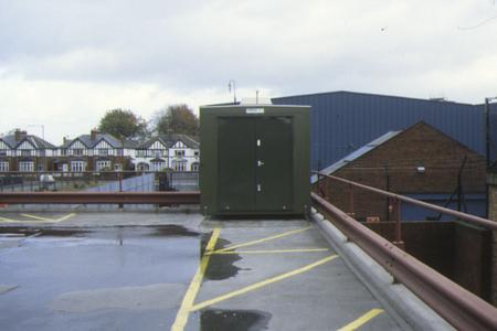
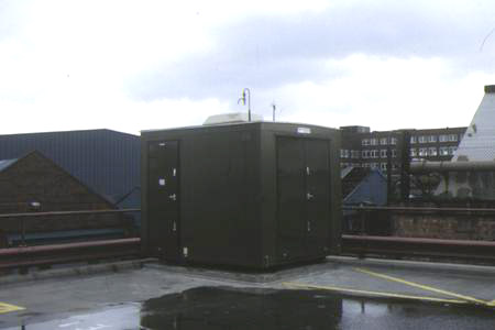
This monitoring station is within a self-contained, air-conditioned housing located on the top (1st) floor of an enclosed car park which serves the Council offices. The nearest minor road is Lombard Road, approximately 20 metres to the NW and the nearest main road (West Bromwich High Street) lies about 90 metres to the SW. The manifold inlet height is approximately 8 metres above ground level. This location is within the commercial centre of West Bromwich.
UK-AIR ID: UKA00374
EU Site ID: GB0698A
Altitude (metres): 172
Environment Type: Urban Background
Site Location
Environment Type: Urban Background
Site Address: Birmingham
Government Region: West Midlands
Easting/Northing: 400399, 291416
Latitude/Longitude: 52.520620, -1.995556

The static map below shows where the monitoring site is located.
» View this location on Google Maps (new window)
Partners
Sorry, no information is currently available
Pollutants measured at this monitoring site
The pollutants measured at this monitoring site, grouped by network, are shown below.
Automatic Urban Monitoring Network
| Pollutant | Start Date | End Date | Inlet Height (m) | Hourly PM Measurement method |
|---|---|---|---|---|
| Ozone | 04/11/1998 | 31/12/2011 | Not available | |
| Nitric oxide | 04/11/1998 | 31/12/2011 | Not available | |
| Nitrogen dioxide | 04/11/1998 | 31/12/2011 | Not available | |
| Nitrogen oxides as nitrogen dioxide | 04/11/1998 | 31/12/2011 | Not available | |
| Sulphur dioxide | 04/11/1998 | 31/12/2011 | Not available | |
| Carbon monoxide | 04/11/1998 | 30/09/2007 | Not available | |
| Modelled Wind Direction | 01/08/2010 | 31/12/2011 | 10 | |
| Modelled Wind Speed | 01/08/2010 | 31/12/2011 | 10 | |
| Modelled Temperature | 01/08/2010 | 31/12/2011 | 2 |
Networks measured at this monitoring site
The listing below shows the networks that this monitoring site belongs to. You can search for sites within these networks by clicking on their name, or use the network information links to find out more about them.
| Network | Search | Further Details | Get Data |
|---|---|---|---|
| Automatic Urban and Rural Monitoring Network (AURN) | Automatic Urban and Rural Monitoring Network (AURN) | About network | Latest pollution summary Current Levels Pre-Formatted Data Files |