
Site Information for London Southwark(UKA00330)
Please Note: This monitoring site is closed.
London Southwark Information
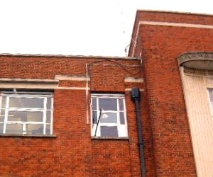
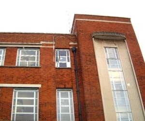
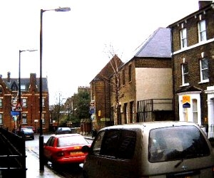
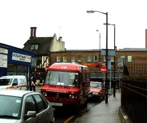
The site is located within an existing building in a quiet residential side street off Walworth Road. The sample point is located at a height of 15m around 35m from Walworth Road. The surrounding area consists mainly of offices and housing. The site is owned and funded by the London Borough of Southwark.
UK-AIR ID: UKA00330
EU Site ID: GB0656A
Altitude (metres): 10
Environment Type: Urban Background
Site Location
Environment Type: Urban Background
Site Address: London
Government Region: Greater London
Easting/Northing: 532238, 178562
Latitude/Longitude: 51.490550, -0.096667
The static map below shows where the monitoring site is located.
» View this location on Google Maps (new window)
Partners
Sorry, no information is currently available
Pollutants measured at this monitoring site
The pollutants measured at this monitoring site, grouped by network, are shown below.
Automatic Urban Monitoring Network
| Pollutant | Start Date | End Date | Inlet Height (m) | Hourly PM Measurement method |
|---|---|---|---|---|
| Ozone | 28/02/1997 | 30/09/2007 | Not available | |
| Nitric oxide | 28/02/1997 | 30/09/2007 | Not available | |
| Nitrogen dioxide | 28/02/1997 | 30/09/2007 | Not available | |
| Nitrogen oxides as nitrogen dioxide | 28/02/1997 | 30/09/2007 | Not available | |
| Sulphur dioxide | 28/02/1997 | 30/09/2007 | Not available | |
| Carbon monoxide | 28/02/1997 | 30/09/2007 | Not available |
Networks measured at this monitoring site
The listing below shows the networks that this monitoring site belongs to. You can search for sites within these networks by clicking on their name, or use the network information links to find out more about them.
| Network | Search | Further Details | Get Data |
|---|---|---|---|
| Automatic Urban and Rural Monitoring Network (AURN) | Automatic Urban and Rural Monitoring Network (AURN) | About network | Latest pollution summary Current Levels Pre-Formatted Data Files |