
Site Information for Northampton(UKA00425)
Please Note: This monitoring site is closed.
Northampton Information
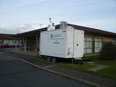
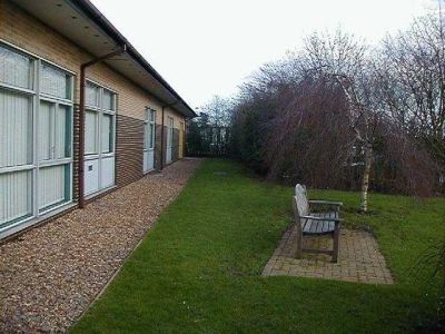
The monitoring station is located within a self contained, air conditioned housing within the grounds of University College Northampton, close to the main entrance. UCN is sited on the northern edge of Northampton. The nearest road to the station is Broughton Green Road, approximately 50 metres to the north west of the station. The nearest main road, Holly Lodge Drive is approximately 300 metres away. The manifold inlets are approximately 3 metres above ground level. The surrounding area consists of residential dwellings.
UK-AIR ID: UKA00425
EU Site ID: GB0738A
Altitude (metres): 129
Environment Type: Urban Background
Site Location
Environment Type: Urban Background
Site Address: Northampton
Government Region: East Midlands
Easting/Northing: 476112, 264511
Latitude/Longitude: 52.273490, -0.885933

The static map below shows where the monitoring site is located.
» View this location on Google Maps (new window)
Partners
The Partners who operate networks at this monitoring sites are shown in the table below. Clicking on the Partner name will open their website in a new window.
| Operator | Networks |
|---|---|
| Ricardo Energy & Environment | Non-Automatic Hydrocarbon Network |
Pollutants measured at this monitoring site
The pollutants measured at this monitoring site, grouped by network, are shown below. Use the links below to quickly jump to a specific network.
Automatic Urban Monitoring Network
| Pollutant | Start Date | End Date | Inlet Height (m) | Hourly PM Measurement method |
|---|---|---|---|---|
| Ozone | 13/03/2003 | 09/07/2012 | 4.0 | |
| Nitric oxide | 23/05/2001 | 09/07/2012 | 4.0 | |
| Nitrogen dioxide | 23/05/2001 | 09/07/2012 | 4.0 | |
| Nitrogen oxides as nitrogen dioxide | 23/05/2001 | 09/07/2012 | 4.0 | |
| Sulphur dioxide | 12/02/2001 | 09/07/2012 | 4.0 | |
| Carbon monoxide | 12/03/2002 | 30/09/2007 | Not available | |
| PM10 particulate matter (Hourly measured) | 12/01/2001 | 07/04/2008 | Not available | TEOM |
| PM2.5 particulate matter (Daily measured) | 01/09/2008 | 09/07/2012 | 4.0 | PARTISOL |
| Daily measured PM2.5 (uncorrected) | 01/09/2008 | 09/07/2012 | Not available | |
| Modelled Wind Direction | 01/08/2010 | 09/07/2012 | 10 | |
| Modelled Wind Speed | 01/08/2010 | 09/07/2012 | 10 | |
| Modelled Temperature | 01/08/2010 | 09/07/2012 | 2 |
Non-Automatic Hydrocarbon Network
| Pollutant | Start Date | End Date | Inlet Height (m) |
|---|---|---|---|
| benzene | 13/03/2002 | 05/07/2012 | 4.0 |
Networks measured at this monitoring site
The listing below shows the networks that this monitoring site belongs to. You can search for sites within these networks by clicking on their name, or use the network information links to find out more about them.
| Network | Search | Further Details | Get Data |
|---|---|---|---|
| Automatic Urban and Rural Monitoring Network (AURN) | Automatic Urban and Rural Monitoring Network (AURN) | About network | Latest pollution summary Current Levels Pre-Formatted Data Files |
| Non-Automatic Hydrocarbon Network | Non-Automatic Hydrocarbon Network | About network | Network Information page |