
Site Information for London Haringey(UKA00261)
Please Note: This monitoring site is closed.
London Haringey Information
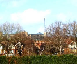
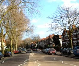
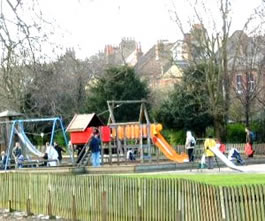
The monitoring station is located within a self-contained, air conditioned housing within the grounds of a park. The nearest road is approximately 40 metres from the station and is a quiet residential access road. The station is approximately 250 metres NE of the A1201 Park Road and 300 metres south of the A504 Priory Road. The station is within the park's service yard and the surrounding area consists of grass, trees, a children's playground and housing. The site is part of the London Air Quality Network and is owned and funded by the London Borough of Haringey.
UK-AIR ID: UKA00261
EU Site ID: GB0638A
Altitude (metres): 30
Environment Type: Urban Background
Site Location
Environment Type: Urban Background
Site Address: London
Government Region: Greater London
Easting/Northing: 529896, 189126
Latitude/Longitude: 51.586030, -0.126486

The static map below shows where the monitoring site is located.
» View this location on Google Maps (new window)
Partners
Sorry, no information is currently available
Pollutants measured at this monitoring site
The pollutants measured at this monitoring site, grouped by network, are shown below.
Automatic Urban Monitoring Network
| Pollutant | Start Date | End Date | Inlet Height (m) | Hourly PM Measurement method |
|---|---|---|---|---|
| Ozone | 16/05/1996 | 24/10/2012 | 3.0 | |
| Nitric oxide | 29/11/2007 | 24/10/2012 | 3.0 | |
| Nitrogen dioxide | 29/11/2007 | 24/10/2012 | 3.0 | |
| Nitrogen oxides as nitrogen dioxide | 29/11/2007 | 24/10/2012 | 3.0 | |
| Modelled Wind Direction | 01/08/2010 | 24/10/2012 | 10 | |
| Modelled Wind Speed | 01/08/2010 | 24/10/2012 | 10 | |
| Modelled Temperature | 01/08/2010 | 24/10/2012 | 2 |
Networks measured at this monitoring site
The listing below shows the networks that this monitoring site belongs to. You can search for sites within these networks by clicking on their name, or use the network information links to find out more about them.
| Network | Search | Further Details | Get Data |
|---|---|---|---|
| Automatic Urban and Rural Monitoring Network (AURN) | Automatic Urban and Rural Monitoring Network (AURN) | About network | Latest pollution summary Current Levels Pre-Formatted Data Files |