
NOAA SBUV/2
« Return to Ozone Maps section
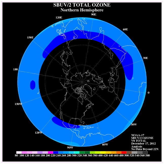
This image loads from an external website (opens in a new window)
The Solar Backscatter Ultraviolet instrument is another instrument that calculates ozone concentrations from radiation scattered by the atmosphere just as the GOME system does. The instrument is currently onboard the NOAA-16 polar orbiting satellite and measures the scattered ultraviolet sunlight at wavelengths ranging from 252 nanometers (nm) to 340 nm.
Measurements at the shortest eight wavelengths are used to estimate ozone vertical profiles by using a maximum likelihood retrieval algorithm. Measurements at the longer four wavelengths, which penetrate into the lower atmosphere, are used to obtain estimates of total column ozone. Total ozone is calculated by using the ratio of two wavelengths of backscattered ultraviolet light where one is strongly absorbed by ozone while the other is absorbed very little. For example, the ratio between 312 nm and 331 nm can be used in this calculation of total columnar ozone. Ozone measurements via satellite have been made by this type of backscatter ultraviolet instrument since the launch of the Nimbus-4 satellite in April 1970.
The improved SolarBackscatter Ultraviolet Instrument (SBUV) was launched in November 1978 and continued until the second generation instrument, the SBUV/2, began with the NOAA TIROS series of satellites in 1984. Operational monitoring of stratospheric ozone began in 1985 with the NOAA-9 satellite and continued to present with the NOAA-11, NOAA-14 and NOAA-16 series. The latest in the series of NOAA polar orbiting satellites, NOAA-M, will also be equipped with an SBUV/2 ozone-measuring instrument when it launches in 2002.