
Site Information for Nottingham Centre(UKA00274)
Please Note: This monitoring site is closed.
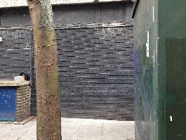
Nottingham Centre Information
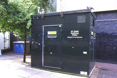
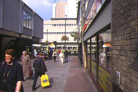
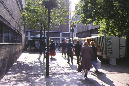
The monitoring station is within a self-contained, air-conditioned housing located in a pedestrianised area. Surrounded by 4 storey commercial buildings. Due to implementation of Turning Point North Scheme the nearest main road, A6008 Lower Parliament Street is now not a major through route within the city centre. Traffic flows primarily comprise of buses and taxis. Only authorised traffic (such as: blue badge holders, private hire vehicles, access for loading / unloading and to off-street car parks) which need access to the Turning Point zone are still able to do so.
UK-AIR ID: UKA00274
EU Site ID: GB0646A
Altitude (metres): 41
Environment Type: Urban Background
PM2.5 Targets This site is used in the assessment of both the Annual Mean Concentration Target (AMCT) and Population Exposure Reduction Target (PERT) under the Environmental Target (Fine Particulate Matter) (England) Regulations 2023, subject to meeting the inclusion criteria on an annual basis. To find out more about how measurements are used to calculate progress towards the targets and which sites have met the inclusion criteria in different years, please see the PM2.5 target calculation page.
Site Location
Environment Type: Urban Background
Site Address: Nottingham
Government Region: East Midlands
Easting/Northing: 457440, 340047
Latitude/Longitude: 52.954730, -1.146447
The static map below shows where the monitoring site is located.
» View this location on Google Maps (new window)
Partners
The Partners who operate networks at this monitoring sites are shown in the table below. Clicking on the Partner name will open their website in a new window.
| Operator | Networks |
|---|---|
| Bureau Veritas | Automatic Urban Monitoring Network |
| Ricardo Energy & Environment | Non-Automatic Hydrocarbon Network |
| Ricardo Energy & Environment | PAH Digitel (solid phase) |
Pollutants measured at this monitoring site
The pollutants measured at this monitoring site, grouped by network, are shown below. Use the links below to quickly jump to a specific network.
- Automatic Urban Monitoring Network
- Non-Automatic Hydrocarbon Network
- PAH Digitel (solid phase)
- UK Black Carbon Network
Automatic Urban Monitoring Network
| Pollutant | Start Date | End Date | Inlet Height (m) | Hourly PM Measurement method |
|---|---|---|---|---|
| Ozone | 02/09/1996 | 30/01/2024 | 2.5 | |
| Nitric oxide | 02/09/1996 | 30/01/2024 | 2.5 | |
| Nitrogen dioxide | 02/09/1996 | 30/01/2024 | 2.5 | |
| Nitrogen oxides as nitrogen dioxide | 02/09/1996 | 30/01/2024 | 2.5 | |
| Sulphur dioxide | 02/09/1996 | 30/01/2024 | 2.5 | |
| Carbon monoxide | 02/09/1996 | 30/09/2007 | Not available | |
| PM10 particulate matter (Hourly measured) | 02/09/1996 | 30/01/2024 | 2.5 | FIDAS |
| PM2.5 particulate matter (Hourly measured) | 19/12/2008 | 30/01/2024 | 2.5 | FIDAS |
| Modelled Wind Direction | 01/08/2010 | 30/01/2024 | 10.0 | |
| Modelled Wind Speed | 01/08/2010 | 30/01/2024 | 10.0 | |
| Modelled Temperature | 01/08/2010 | 30/01/2024 | 2.0 |
Non-Automatic Hydrocarbon Network
| Pollutant | Start Date | End Date | Inlet Height (m) |
|---|---|---|---|
| benzene | 14/03/2002 | 23/01/2024 | 4.0 |
PAH Digitel (solid phase)
| Pollutant | Start Date | End Date | Inlet Height (m) |
|---|---|---|---|
| Benzo(a)pyrene | 16/11/2016 | 23/01/2024 | 2.0 |
| Benzo(a)anthracene | 16/11/2016 | 23/01/2024 | 2.0 |
| Benzo(b)fluoranthene | 16/11/2016 | 23/01/2024 | 2.0 |
| Benzo(j)fluoranthene | 16/11/2016 | 23/01/2024 | 2.0 |
| Benzo(k)fluoranthene | 16/11/2016 | 23/01/2024 | 2.0 |
| Indeno(1,2,3-cd)pyrene | 16/11/2016 | 23/01/2024 | 2.0 |
| Dibenzo(ac)anthracene | 16/11/2016 | 23/01/2024 | 2.0 |
| Dibenzo(ah)anthracene | 16/11/2016 | 23/01/2024 | 2.0 |
| 5-Methyl Chrysene | 16/11/2016 | 23/01/2024 | 2.0 |
| Anthanthrene | 16/11/2016 | 23/01/2024 | 2.0 |
| Anthracene | 01/01/2021 | 23/01/2024 | 2.0 |
| Benzo(b)naphtho(2,1-d)thiophene | 16/11/2016 | 23/01/2024 | 2.0 |
| Benzo(c)phenanthrene | 16/11/2016 | 23/01/2024 | 2.0 |
| Benzo(e)pyrene | 16/11/2016 | 23/01/2024 | 2.0 |
| Benzo(ghi)perylene | 16/11/2016 | 23/01/2024 | 2.0 |
| Cholanthrene | 16/11/2016 | 01/05/2019 | 2.0 |
| Chrysene | 16/11/2016 | 23/01/2024 | 2.0 |
| Coronene | 16/11/2016 | 23/01/2024 | 2.0 |
| Cyclopenta(c,d)pyrene | 16/11/2016 | 23/01/2024 | 2.0 |
| Dibenzo(al)pyrene | 16/11/2016 | 23/01/2024 | 2.0 |
| Dibenzo(ae)pyrene | 16/11/2016 | 23/01/2024 | 2.0 |
| Dibenzo(ai)pyrene | 16/11/2016 | 23/01/2024 | 2.0 |
| Dibenzo(ah)pyrene | 16/11/2016 | 23/01/2024 | 2.0 |
| Fluoranthene | 01/01/2021 | 23/01/2024 | 2.0 |
| Perylene | 16/11/2016 | 23/01/2024 | 2.0 |
| Phenanthrene | 01/01/2021 | 23/01/2024 | 2.0 |
| Pyrene | 01/01/2021 | 23/01/2024 | 2.0 |
| Retene | 01/01/2021 | 23/01/2024 | 2.0 |
UK Black Carbon Network
| Pollutant | Start Date | End Date | Inlet Height (m) |
|---|---|---|---|
| Black smoke | 22/03/2007 | 06/11/2008 | Not available |
| Black Carbon (880nm) | 07/11/2008 | 22/03/2012 | 3.0 |
| UV Particulate Matter (UV-BC) | 07/11/2008 | 22/03/2012 | 3.0 |
Networks measured at this monitoring site
The listing below shows the networks that this monitoring site belongs to. You can search for sites within these networks by clicking on their name, or use the network information links to find out more about them.
| Network | Search | Further Details | Get Data |
|---|---|---|---|
| Automatic Urban and Rural Monitoring Network (AURN) | Automatic Urban and Rural Monitoring Network (AURN) | About network | Latest pollution summary Current Levels Pre-Formatted Data Files |
| Black Carbon | Black Carbon | About network | Data Selector |
| Non-Automatic Hydrocarbon Network | Non-Automatic Hydrocarbon Network | About network | Network Information page |
| PAH Digitel (solid phase) | PAH Digitel (solid phase) | About network | PAH data download page |