
Site Information for Wardlow Hay Cop(UKA00119)
Wardlow Hay Cop Information
Sorry, no information about this site is currently available.
UK-AIR ID: UKA00119
EU Site ID: GB0151R
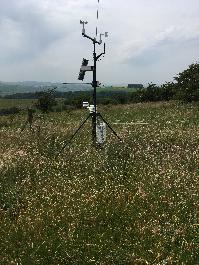
Altitude (metres): 350
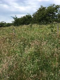
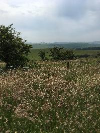
Environment Type: Rural Background
Site Location
Environment Type: Rural Background
Site Address: Not available
Government Region: East Midlands
Easting/Northing: 417722, 373890
Latitude/Longitude: 53.261715, -1.735789
The static map below shows where the monitoring site is located.
» View this location on Google Maps (new window)
» View this monitoring site on the interactive monitoring networks map
Partners
The Partners who operate networks at this monitoring sites are shown in the table below. Clicking on the Partner name will open their website in a new window.
| Operator | Networks |
|---|---|
| Ricardo Energy & Environment | Weekly rainfall (LOW) |
| Centre for Ecology & Hydrology | National Ammonia Monitoring Network |
Pollutants measured at this monitoring site
The pollutants measured at this monitoring site, grouped by network, are shown below. Use the links below to quickly jump to a specific network.
- National Ammonia Monitoring Network
- Other AP system network
- UKEAP - Rural NO2 (NO2-Net)
- Weekly rainfall (LOW)
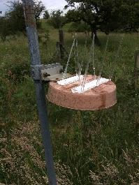
National Ammonia Monitoring Network
| Pollutant | Start Date | End Date | Inlet Height (m) |
|---|---|---|---|
| gaseous ammonia (passive) | 06/08/2010 | - | 1.5 |
Other AP system network
| Pollutant | Start Date | End Date | Inlet Height (m) |
|---|---|---|---|
| Nitrogen dioxide as N | 25/06/1991 | 04/01/1993 | Not available |
UKEAP - Rural NO2 (NO2-Net)
| Pollutant | Start Date | End Date | Inlet Height (m) |
|---|---|---|---|
| Nitrogen dioxide | 05/01/1993 | 23/04/2006 | Not available |
Weekly rainfall (LOW)
| Pollutant | Start Date | End Date | Inlet Height (m) |
|---|---|---|---|
| Calcium in precipitation | 22/01/1986 | - | 1.5 |
| Chloride in precipitation | 22/01/1986 | - | 1.5 |
| Potassium in precipitation | 22/01/1986 | - | 1.5 |
| Magnesium in precipitation | 22/01/1986 | - | 1.5 |
| Sodium in precipitation | 22/01/1986 | - | 1.5 |
| Phosphate as P in precipitation | 22/01/1986 | - | 1.5 |
| Nitrate as N in precipitation | 22/01/1986 | - | 1.5 |
| Ammonium as N in precipitation | 22/01/1986 | - | 1.5 |
| Sulphate as S in precipitation | 22/01/1986 | - | 1.5 |
| Non-marine sulphate as S in precipitation | 22/01/1986 | - | 1.5 |
| Acidity in precipitation | 22/01/1986 | - | 1.5 |
| Conductivity | 22/01/1986 | - | 1.5 |
| pH in precipitation | 22/01/1986 | - | 1.5 |
| Rainfall | 22/01/1986 | - | 1.5 |
| Fluoride | 26/02/2012 | - | 1.5 |
Networks measured at this monitoring site
The listing below shows the networks that this monitoring site belongs to. You can search for sites within these networks by clicking on their name, or use the network information links to find out more about them.
| Network | Search | Further Details | Get Data |
|---|---|---|---|
| UKEAP: National Ammonia Monitoring Network | UKEAP: National Ammonia Monitoring Network | About network | Data Selector |
| UKEAP: Precip-Net | UKEAP: Precip-Net | About network | Data Selector |
| UKEAP: Rural NO2 | UKEAP: Rural NO2 | About network | Data Selector |