Site Information for Walsall Bilston Lane(UKA00475)
Please Note: This monitoring site is closed.
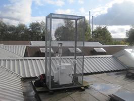
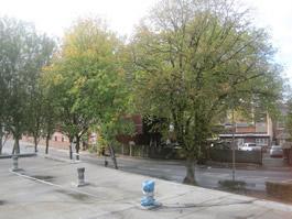
Walsall Bilston Lane Information
Sorry, no information about this site is currently available.
UK-AIR ID: UKA00475
EU Site ID: GB0983A
Altitude (metres): 148
Environment Type: Urban Industrial
Site Location
Environment Type: Urban Industrial
Site Address: Walsall
Government Region: West Midlands
Easting/Northing: 397197, 298370
Latitude/Longitude: 52.583131, -2.042801
The static map below shows where the monitoring site is located.
» View this location on Google Maps (new window)
Partners
The Partners who operate networks at this monitoring sites are shown in the table below. Clicking on the Partner name will open their website in a new window.
| Operator | Networks |
|---|---|
| National Physical Laboratory | Heavy Metals Network |
Pollutants measured at this monitoring site
The pollutants measured at this monitoring site, grouped by network, are shown below.
Heavy Metals Network
| Pollutant | Start Date | End Date | Inlet Height (m) |
|---|---|---|---|
| Arsenic | 01/01/2004 | 29/08/2018 | 4.0 |
| Cadmium | 01/01/2004 | 29/08/2018 | 4.0 |
| Chromium | 01/01/2004 | 29/08/2018 | 4.0 |
| Cobalt | 01/04/2011 | 29/08/2018 | 4.0 |
| Copper | 01/01/2004 | 29/08/2018 | 4.0 |
| Iron | 01/01/2004 | 29/08/2018 | 4.0 |
| Lead | 01/01/2004 | 29/08/2018 | 4.0 |
| Manganese | 01/01/2004 | 29/08/2018 | 4.0 |
| mercury in PM10 | 01/01/2004 | 31/12/2013 | 4.0 |
| total gaseous mercury | 01/01/2004 | 31/12/2013 | 4.0 |
| Nickel | 01/01/2004 | 29/08/2018 | 4.0 |
| Platinum | 01/01/2004 | 31/12/2013 | 4.0 |
| Selenium | 01/04/2011 | 29/08/2018 | 4.0 |
| Vanadium | 01/01/2004 | 29/08/2018 | 4.0 |
| Zinc | 01/01/2004 | 29/08/2018 | 4.0 |
Networks measured at this monitoring site
The listing below shows the networks that this monitoring site belongs to. You can search for sites within these networks by clicking on their name, or use the network information links to find out more about them.
| Network | Search | Further Details | Get Data |
|---|---|---|---|
| Heavy Metals | Heavy Metals | About network | Metals data download page Data Selector |