
Site Information for Tower Hamlets Roadside(UKA00257)
Please Note: This monitoring site is closed.
Tower Hamlets Roadside Information
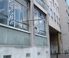
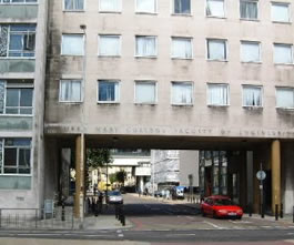
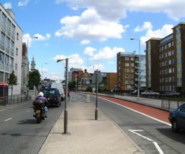
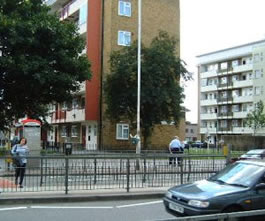
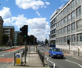
The monitoring station is located within an existing building, part of Queen Mary and Westfield College on the A11 Mile End Road. The road is a dual carridgeway and frequently congested. The surrounding area mainly comprises of the campus of the University with commercial and residential premises nearby. The site is part of the London Air Quality Network and is owned and funded by the London Borough of Tower Hamlets. The monitoring station is located approximately 4 metres from the kerb.
UK-AIR ID: UKA00257
EU Site ID: GB0624A
Altitude (metres): 20
Environment Type: Urban Traffic
Site Location
Environment Type: Urban Traffic
Site Address: London
Government Region: Greater London
Easting/Northing: 535927, 182218
Latitude/Longitude: 51.522530, -0.042155
The static map below shows where the monitoring site is located.
» View this location on Google Maps (new window)
Partners
The Partners who operate networks at this monitoring sites are shown in the table below. Clicking on the Partner name will open their website in a new window.
| Operator | Networks |
|---|---|
| Bureau Veritas | Automatic London Monitoring Network |
| Ricardo Energy & Environment | Non-Automatic Hydrocarbon Network |
Pollutants measured at this monitoring site
The pollutants measured at this monitoring site, grouped by network, are shown below. Use the links below to quickly jump to a specific network.
Automatic London Monitoring Network
| Pollutant | Start Date | End Date | Inlet Height (m) | Hourly PM Measurement method |
|---|---|---|---|---|
| Nitric oxide | 01/04/1996 | 31/01/2025 | 3.0 | |
| Nitrogen dioxide | 01/04/1996 | 31/01/2025 | 3.0 | |
| Nitrogen oxides as nitrogen dioxide | 01/04/1996 | 31/01/2025 | 3.0 | |
| Carbon monoxide | 01/04/1996 | 31/12/2012 | 3.0 | |
| Modelled Wind Direction | 01/08/2010 | 31/01/2025 | 10.0 | |
| Modelled Wind Speed | 01/08/2010 | 31/01/2025 | 10.0 | |
| Modelled Temperature | 01/08/2010 | 31/01/2025 | 2.0 |
Non-Automatic Hydrocarbon Network
| Pollutant | Start Date | End Date | Inlet Height (m) |
|---|---|---|---|
| benzene | 07/11/2012 | 09/01/2025 | 3.0 |
Networks measured at this monitoring site
The listing below shows the networks that this monitoring site belongs to. You can search for sites within these networks by clicking on their name, or use the network information links to find out more about them.
| Network | Search | Further Details | Get Data |
|---|---|---|---|
| Automatic Urban and Rural Monitoring Network (AURN) | Automatic Urban and Rural Monitoring Network (AURN) | About network | Data Selector |
| Non-Automatic Hydrocarbon Network | Non-Automatic Hydrocarbon Network | About network | Network Information page |