AQMA Details
« Return to Local Authority listing
The AQMA details for are shown below:
Amendment History
The below table provides information on the amendment history of this AQMA
| AQMA Name | AQMA Status | Pollutants | Date |
|---|---|---|---|
| Lowesmoor/Rainbow Hill AQMA | Declared | Nitrogen dioxide NO2 | 01/03/2009 |
| Lowesmoor/Rainbow Hill AQMA | Revoked | 11/06/2019 |
Pollutants Declared
- 01/03/2009, Nitrogen dioxide NO2 - Annual Mean
Lowesmoor/Rainbow Hill AQMA (Worcester City Council)
01/03/2009, An area encompassing the entire length of Lowesmoor, Lowesmoor Terrace, Rainbow Hill and Astwood Road (up to the junction with Bilford Road), including all properties, whether residential or commercial, abutting the pavements of these roads.
Source: County or Unitary Authority Road
Click the map below to open a full size version in a new window.
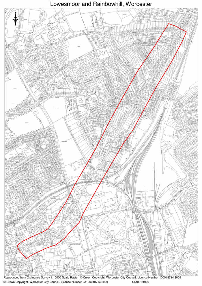
© Crown copyright. All rights reserved. DEFRA. Licence No. GD272361 2002
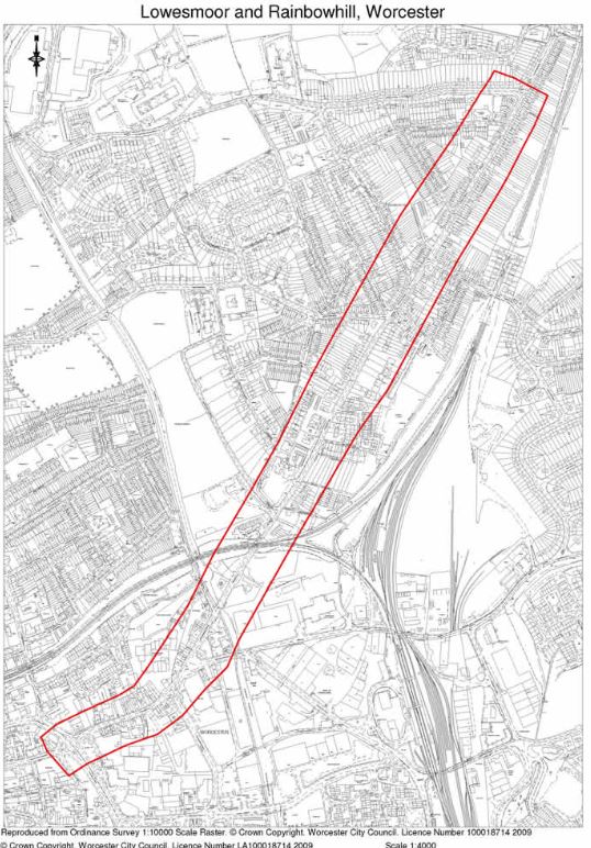
Lowesmoor/Rainbow Hill AQMA (Worcester City Council)
11/06/2019, An area encompassing the entire length of Lowesmoor, Lowesmoor Terrace, Rainbow Hill and Astwood Road (up to the junction with Bilford Road), including all properties, whether residential or commercial, abutting the pavements of these roads. Air Quality Management Area (Political Boundary of Worcester City) Order 2019 is defined as the political boundary of Worcester City which incorporates the areas previously identified within Air Quality Management Area Orders made on the 20th February 2009 and 26th September 2014
Source: County or Unitary Authority Road