AQMA Details
« Return to Local Authority listing
The AQMA details for are shown below:
Amendment History
The below table provides information on the amendment history of this AQMA
| AQMA Name | AQMA Status | Pollutants | Date |
|---|---|---|---|
| Lyndhurst AQMA | Declared | Nitrogen dioxide NO2 | 06/06/2005 |
| Lyndhurst AQMA | Revoked | Nitrogen dioxide NO2 | 18/08/2023 |
Pollutants Declared
- 06/06/2005, Nitrogen dioxide NO2 - Annual Mean
- 18/08/2023, Nitrogen dioxide NO2 - Annual Mean
Lyndhurst AQMA (New Forest District Council)
06/06/2005, An area extending 25m either side of both kerbs in the High Street, Lyndhurst between Lyndhurst Infant School and Forest Cottage, 97 High Street.
Source: County or Unitary Authority Road
Click the map below to open a full size version in a new window.
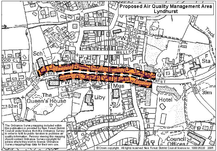
© Crown copyright. All rights reserved. DEFRA. Licence No. GD272361 2002
Lyndhurst AQMA (New Forest District Council)
18/08/2023, An area extending 25m either side of both kerbs in the High Street, Lyndhurst between Lyndhurst Infant School and Forest Cottage, 97 High Street.
Source: County or Unitary Authority Road
There is no map of this AQMA available for download.