AQMA Details
« Return to Local Authority listing
The AQMA details for are shown below:
Amendment History
The below table provides information on the amendment history of this AQMA
| AQMA Name | AQMA Status | Pollutants | Date |
|---|---|---|---|
| Eastleigh AQMA No.1 (A335) | Declared | Nitrogen dioxide NO2 | 16/02/2005 |
| Eastleigh AQMA No.1 (A335) | Amended | Nitrogen dioxide NO2 | 03/02/2015 |
Pollutants Declared
- 16/02/2005, Nitrogen dioxide NO2 - Annual Mean
- 03/02/2015, Nitrogen dioxide NO2 - Annual Mean
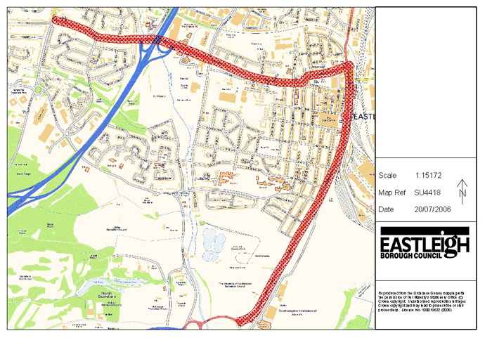
Eastleigh AQMA No.1 (A335) (Eastleigh Borough Council)
16/02/2005, The AQMA encompasses an area extending 30m to either side of the A335 from the junction of Leigh Road and Bournemouth Road to Wide Lane (north of the roundabout with the M27 spur).
Source: Road transport unspecified
Click the map below to open a full size version in a new window.
© Crown copyright. All rights reserved. DEFRA. Licence No. GD272361 2002
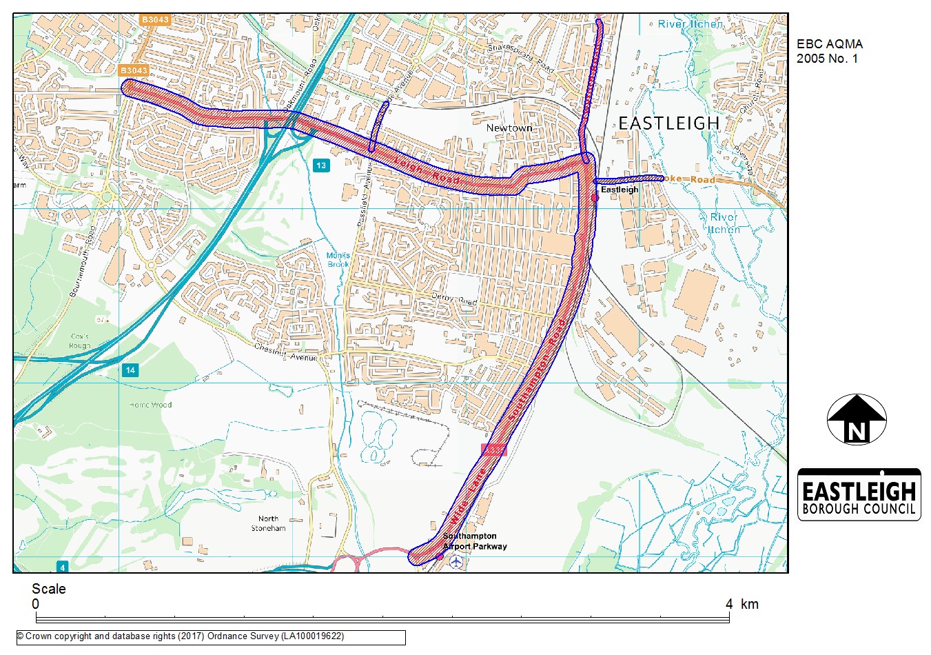
Eastleigh AQMA No.1 (A335) (Eastleigh Borough Council)
03/02/2015, The AQMA encompasses an area extending 30m to either side of the A335 from the junction of Leigh Road and Bournemouth Road to Wide Lane (north of the roundabout with the M27 spur), and a 15m corridor each side of Woodside Avenue north from the junction with the A335 Leigh Road and Passfield Avenue to the railway bridge, Twyford Road north from the junction with Romsey Road and A335 Station Hill to the junction with St Catherines Road, and the B3037 Bishopstoke Road west from junction with the A335 Station Hill to and including the roundabout with Chickenhall Lane.
Source: Road transport unspecified
Click the map below to open a full size version in a new window.
© Crown copyright. All rights reserved. DEFRA. Licence No. GD272361 2002