
Air quality plan for nitrogen dioxide (NO2) in the UK, 2017
The Government's revised Air quality plan for tackling nitrogen dioxide in the UK can be found at https://www.gov.uk/government/publications/air-quality-plan-for-nitrogen-dioxide-no2-in-uk-2017.
The individual zone plans for the 37 air quality zones still to meet the nitrogen dioxide limits are available to download from the 2017 zone plans documents page.
NO2 projections data are available to download from the 2017 NO2 projections data (2015 reference year) page. The most recent NO2 projections data is available to download.
The Government's supplement to the UK plan for tackling nitrogen dioxide can be found at https://www.gov.uk/government/publications/air-quality-plan-for-nitrogen-dioxide-no2-in-uk-2017.
The targeted feasibility studies submitted to UK Government are available to download from the targeted feasibility study page.
Previous archived air quality plan for the achievement of EU air quality limit values for
nitrogen dioxide (NO2) in the UK, 2015
In December 2015, Defra and the devolved administrations published updated air quality plans for the achievement of the NO2 limits in the UK as soon as possible. These are now replaced by the 2017 plan linked above. The 2015 plan can be found at https://www.gov.uk/government/publications/air-quality-in-the-uk-plan-to-reduce-nitrogen-dioxide-emissions.
High resolution maps showing the modelled effects of this plan 2020 and 2025 can be found below.
- NO2 plan scenario, high resolution map of urban major roads, annual mean roadside NO2 concentration, 2020 (µgm-3) (PDF 3MB)
- NO2 plan scenario, high resolution map of urban major roads, annual mean roadside NO2 concentration, 2025 (µgm-3) (PDF 3MB)
The air quality plan has been submitted to the European Commission for their assessment.
NO2 projections data are available to download from the 2015 NO2 projections data (2013 reference year) page.
Updated projections for future compliance are included in the UK overview document.
Previous archived UK Air quality plans for achieving EU air quality
limit values for NO2 in the UK, 2011
In September 2011, Defra and the devolved administrations published updated air quality plans for the achievement of the NO2 limits in the UK as soon as possible. These are now replaced by the new plans linked above. The 2011 plans package was made up of:
- A UK overview document (PDF 980KB) summarising the relevant air quality policy background and past, present and planned national measures to help tackle NO2 pollution. Updated projections (July 2014) for NO2 compliance are available (PDF 996KB).
- A list of UK and National measures (PDF 800KB) that had helped to reduce or were expected to reduce concentrations of NO2.
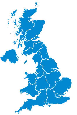
- Air quality plans for 40 air quality zones in the UK (see map below for plans).
- A technical report (PDF 2.2MB) on the modeling and assessment methods used to assess the effectiveness of measures in reducing NO2 concentrations in each zone.
- Download all September 2011 zone specific air quality plan documents available on this website as a zip file (ZIP 50Mb)
The air quality plans for each zone, along with the documents above, were submitted to the European Commission for their assessment. The submission also included forms that summarise the essential information for each zone plan.
- Download a ZIP file of zone specific forms (Zones 1-20) (ZIP 3MB)
- Download a ZIP file of zone specific forms (Zones 21-43) (ZIP 3MB)
In June 2012, the European Commission published its assessment of 24 of the 40 Air quality plans in a Decision (PDF - opens in a new window). In response to the conclusions in this Decision, the UK submitted to the Commission new evidence with respect to projected compliance in the Northern Ireland zone and Re-Notifications for the Birkenhead, Preston and Swansea zones. These documents can be found by linking to the Plans page for the respective zone and are available for download as a zip file below:
Download a ZIP file of all documents relating to Re-Notifications and supply of new evidence in 2012 (ZIP)
The map below contains links to the 2011 40 Air Quality Zone Plans (for 27 urban agglomerations and 13 non-agglomeration zones), 40 Forms and relevant local authority Action Plans. Plans and forms were not produced for the three UK air quality zones already compliant with the NO2 limit values. These zones are Blackpool Urban Area, Highland and Scottish Borders.
To quickly navigate through the reports, you can select a UK region from the dropdown boxes below or click on the map - reports for that zone will then be shown grouped by Local Authority.
Please note that some reports may appear in more than one local authority if applicable to both.
By Non-Agglomeration Zone
By Agglomeration Zone
By Local Authority Name
Start typing a local authority name and choose from the results that appear.