Site Information for Southampton A33(UKA00613)
Southampton A33 Information
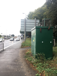
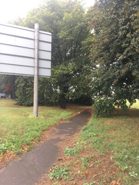
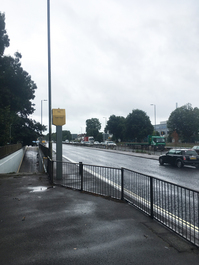
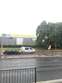
This site is situated approximately 5m from the eastbound carriageway of the A33. Located 200m west of Parkside Avenue.
UK-AIR ID: UKA00613
EU Site ID: GB1056A
Altitude (metres): 5
Environment Type: Urban Traffic
Site Location
Environment Type: Urban Traffic
Site Address: Not available
Government Region: South East
Easting/Northing: 437809, 113560
Latitude/Longitude: 50.920265, -1.463484
The static map below shows where the monitoring site is located.
» View this location on Google Maps (new window)
» View this monitoring site on the interactive monitoring networks map
Partners
The Partners who operate networks at this monitoring sites are shown in the table below. Clicking on the Partner name will open their website in a new window.
| Operator | Networks |
|---|---|
| Bureau Veritas | Automatic Urban Monitoring Network |
Pollutants measured at this monitoring site
The pollutants measured at this monitoring site, grouped by network, are shown below. Use the links below to quickly jump to a specific network.
Automatic Urban Monitoring Network
| Pollutant | Start Date | End Date | Inlet Height (m) | Hourly PM Measurement method |
|---|---|---|---|---|
| Nitric oxide | 01/01/2016 | - | 2.5 | |
| Nitrogen dioxide | 01/01/2016 | - | 2.5 | |
| Nitrogen oxides as nitrogen dioxide | 01/01/2016 | - | 2.5 | |
| PM10 particulate matter (Hourly measured) | 01/01/2016 | - | 2.5 | BAM1020heated |
| Non-volatile PM10 (Hourly measured) | 01/01/2016 | 20/02/2020 | 0.0 | |
| Volatile PM10 (Hourly measured) | 01/01/2016 | 20/02/2020 | 0.0 | |
| Modelled Wind Direction | 01/01/2016 | - | Not available | |
| Modelled Wind Speed | 01/01/2016 | - | Not available | |
| Modelled Temperature | 01/01/2016 | - | Not available | |
| PM10 Ambient Temperature | 01/01/2016 | 20/02/2020 | Not available | |
| PM10 Ambient pressure measured | 01/01/2016 | 20/02/2020 | Not available |
UK Urban NO2 Network
| Pollutant | Start Date | End Date | Inlet Height (m) |
|---|---|---|---|
| Nitrogen dioxide (corrected) | 02/01/2020 | - | 2.5 |
Networks measured at this monitoring site
The listing below shows the networks that this monitoring site belongs to. You can search for sites within these networks by clicking on their name, or use the network information links to find out more about them.
| Network | Search | Further Details | Get Data |
|---|---|---|---|
| Automatic Urban and Rural Monitoring Network (AURN) | Automatic Urban and Rural Monitoring Network (AURN) | About network | Latest pollution summary Current Levels Pre-Formatted Data Files |
| UK Urban NO2 Network | UK Urban NO2 Network | About network | Data Selector Network Information page |