Site Information for Lerwick(UKA00486)
Lerwick Information
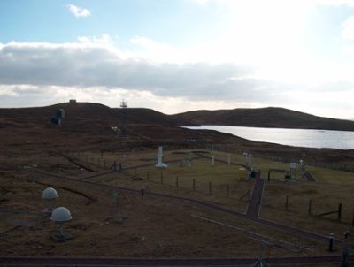
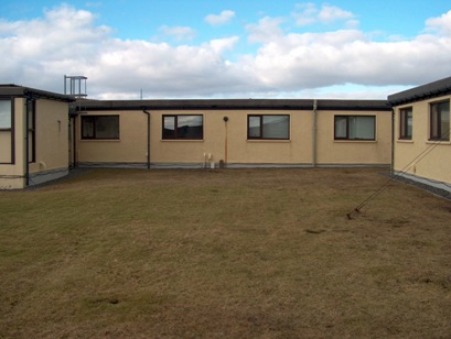
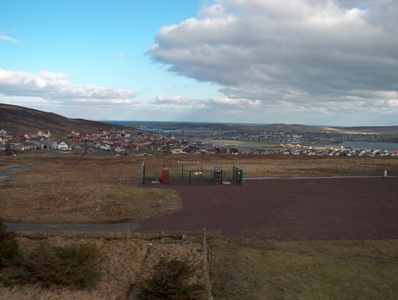
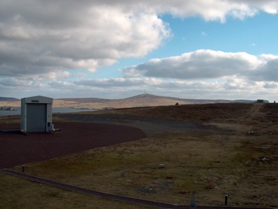
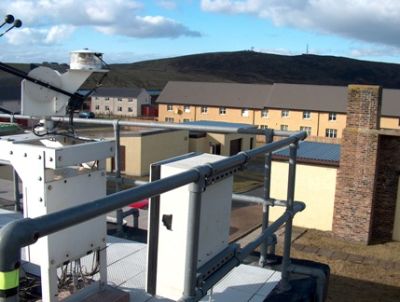
Monitoring site in the instrument compound of the Met Office observatory near Lerwick.
UK-AIR ID: UKA00486
EU Site ID: GB0881A
Altitude (metres): 80
Environment Type: Rural Background
Site Location
Environment Type: Rural Background
Site Address: Met Office Observatory Lerwick
Government Region: Highland
Easting/Northing: 445351, 1139690
Latitude/Longitude: 60.139220, -1.185319
The static map below shows where the monitoring site is located.
» View this location on Google Maps (new window)
» View this monitoring site on the interactive monitoring networks map
Partners
The Partners who operate networks at this monitoring sites are shown in the table below. Clicking on the Partner name will open their website in a new window.
| Operator | Networks |
|---|---|
| HSA | Ozone-UV |
| Bureau Veritas | Automatic Rural Monitoring Network |
Pollutants measured at this monitoring site
The pollutants measured at this monitoring site, grouped by network, are shown below. Use the links below to quickly jump to a specific network.
- Acid Gas and Aerosol Network
- Automatic Rural Monitoring Network
- National Ammonia Monitoring Network
- Ozone-UV
Acid Gas and Aerosol Network
| Pollutant | Start Date | End Date | Inlet Height (m) |
|---|---|---|---|
| Particulate calcium | 01/01/2006 | 31/10/2016 | 1.5 |
| Particulate chloride | 01/01/2006 | 31/10/2016 | 1.5 |
| Particulate magnesium | 01/01/2006 | 31/10/2016 | 1.5 |
| Particulate sodium | 01/01/2006 | 31/10/2016 | 1.5 |
| Particulate nitrite | 01/07/2009 | 31/10/2016 | 1.5 |
| Particulate nitrate | 01/01/2006 | 31/10/2016 | 1.5 |
| Particulate sulphate | 01/01/2006 | 31/10/2016 | 1.5 |
| Gaseous hydrochloric acid | 01/01/2006 | 01/01/2016 | 1.5 |
| Gaseous nitric acid | 01/01/2006 | 31/10/2016 | 1.5 |
| Gaseous nitrous acid | 01/07/2009 | 31/10/2016 | 1.5 |
| Gaseous sulphur dioxide | 01/01/2006 | 31/10/2016 | 1.5 |
Automatic Rural Monitoring Network
| Pollutant | Start Date | End Date | Inlet Height (m) | Hourly PM Measurement method |
|---|---|---|---|---|
| Ozone | 25/05/2005 | - | 4.0 | |
| Modelled Wind Direction | 01/08/2010 | - | Not available | |
| Modelled Wind Speed | 01/08/2010 | - | Not available | |
| Modelled Temperature | 01/08/2010 | - | Not available |
National Ammonia Monitoring Network
| Pollutant | Start Date | End Date | Inlet Height (m) |
|---|---|---|---|
| particulate ammonium | 01/04/1999 | 01/11/2016 | 1.5 |
| gaseous ammonia (active) | 24/03/1997 | 01/11/2016 | 1.5 |
Ozone-UV
| Pollutant | Start Date | End Date | Inlet Height (m) |
|---|---|---|---|
| Stratospheric Ozone | 16/01/1990 | - | Not available |
| Total Ultraviolet radiation | 01/01/1993 | - | Not available |
Networks measured at this monitoring site
The listing below shows the networks that this monitoring site belongs to. You can search for sites within these networks by clicking on their name, or use the network information links to find out more about them.
| Network | Search | Further Details | Get Data |
|---|---|---|---|
| Automatic Urban and Rural Monitoring Network (AURN) | Automatic Urban and Rural Monitoring Network (AURN) | About network | Latest pollution summary Current Levels Pre-Formatted Data Files |
| Ozone / UV | Not available | About network | Stratospheric Ozone Data UV Radiation Data |
| UKEAP: Acid Gases & Aerosol Network | UKEAP: Acid Gases & Aerosol Network | About network | CEH Website (External website) Data Selector |
| UKEAP: National Ammonia Monitoring Network | UKEAP: National Ammonia Monitoring Network | About network | CEH Website (External website) Data Selector |