Site Information for Ladybower(UKA00171)
Ladybower Information
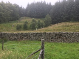
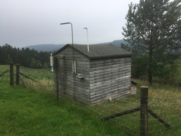
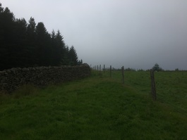
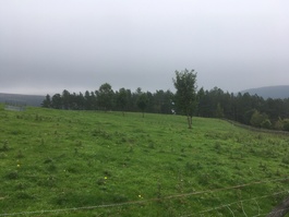
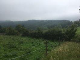
The monitoring station is located within a self-contained, air conditioned housing located in the Peak District National Park approximately 800 metres to the south west of Ladybower reservoir. The nearest road is for access to the nearby farm buildings only, and is approximately 20 metres from the station. The surrounding area is mainly open moor land with the nearest trees occurring within a distance of several hundred metres.
UK-AIR ID: UKA00171
EU Site ID: GB0037R
Altitude (metres): 420
Environment Type: Rural Background
Site Location
Environment Type: Rural Background
Site Address: Ladybower
Government Region: East Midlands
Easting/Northing: 416585, 389645
Latitude/Longitude: 53.403370, -1.752006
The static map below shows where the monitoring site is located.
» View this location on Google Maps (new window)
» View this monitoring site on the interactive monitoring networks map
Partners
The Partners who operate networks at this monitoring sites are shown in the table below. Clicking on the Partner name will open their website in a new window.
| Operator | Networks |
|---|---|
| UK Centre for Ecology & Hydrology | Acid Gas and Aerosol Network |
| UK Centre for Ecology & Hydrology | National Ammonia Monitoring Network |
| Bureau Veritas | Automatic Rural Monitoring Network |
Pollutants measured at this monitoring site
The pollutants measured at this monitoring site, grouped by network, are shown below. Use the links below to quickly jump to a specific network.
Acid Gas and Aerosol Network
| Pollutant | Start Date | End Date | Inlet Height (m) |
|---|---|---|---|
| Gaseous hydrochloric acid | 02/02/2006 | 11/01/2016 | 1.5 |
Automatic Rural Monitoring Network
| Pollutant | Start Date | End Date | Inlet Height (m) | Hourly PM Measurement method |
|---|---|---|---|---|
| Ozone | 15/07/1988 | - | 4.0 | |
| Nitric oxide | 27/10/1988 | - | 4.0 | |
| Nitrogen dioxide | 27/10/1988 | - | 4.0 | |
| Nitrogen oxides as nitrogen dioxide | 27/10/1988 | - | 4.0 | |
| Sulphur dioxide | 07/08/1988 | - | 4.0 | |
| Modelled Wind Direction | 01/08/2010 | - | Not available | |
| Modelled Wind Speed | 01/08/2010 | - | Not available | |
| Modelled Temperature | 01/08/2010 | - | Not available |
Networks measured at this monitoring site
The listing below shows the networks that this monitoring site belongs to. You can search for sites within these networks by clicking on their name, or use the network information links to find out more about them.
| Network | Search | Further Details | Get Data |
|---|---|---|---|
| Automatic Urban and Rural Monitoring Network (AURN) | Automatic Urban and Rural Monitoring Network (AURN) | About network | Latest pollution summary Current Levels Pre-Formatted Data Files |
| UKEAP: Acid Gases & Aerosol Network | UKEAP: Acid Gases & Aerosol Network | About network | CEH Website (External website) Data Selector |
| UKEAP: National Ammonia Monitoring Network | UKEAP: National Ammonia Monitoring Network | About network | CEH Website (External website) Data Selector |