Site Information for Bristol Temple Way(UKA00631)
Bristol Temple Way Information
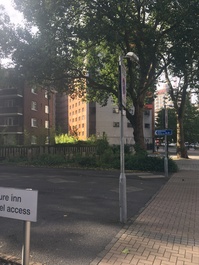
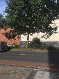
Roadside monitoring station beside multi-lane section of the A4044 (Temple Way), a major route in and out of Bristol city centre. Close to a hotel, shops and flats. Located adjacent to Champion Square. The monitoring station is located approximately 5 metres from the kerb.
UK-AIR ID: UKA00631
EU Site ID: GB1072A
Altitude (metres): 13
Environment Type: Urban Traffic
Site Location
Environment Type: Urban Traffic
Site Address: Bristol
Government Region: South West
Easting/Northing: 359523, 173383
Latitude/Longitude: 51.457968, -2.583975
The static map below shows where the monitoring site is located.
» View this location on Google Maps (new window)
» View this monitoring site on the interactive monitoring networks map
Partners
The Partners who operate networks at this monitoring sites are shown in the table below. Clicking on the Partner name will open their website in a new window.
| Operator | Networks |
|---|---|
| Bureau Veritas | Automatic Urban Monitoring Network |
Pollutants measured at this monitoring site
The pollutants measured at this monitoring site, grouped by network, are shown below. Use the links below to quickly jump to a specific network.
Automatic Urban Monitoring Network
| Pollutant | Start Date | End Date | Inlet Height (m) | Hourly PM Measurement method |
|---|---|---|---|---|
| Nitric oxide | 01/04/2017 | - | 2.0 | |
| Nitrogen dioxide | 01/04/2017 | - | 2.0 | |
| Nitrogen oxides as nitrogen dioxide | 01/04/2017 | - | 2.0 | |
| PM10 particulate matter (Hourly measured) | 01/11/2017 | - | 1.5 | BAM1020heated |
| Modelled Wind Direction | 01/04/2017 | - | Not available | |
| Modelled Wind Speed | 01/04/2017 | - | Not available | |
| Modelled Temperature | 01/04/2017 | - | Not available |
UK Urban NO2 Network
| Pollutant | Start Date | End Date | Inlet Height (m) |
|---|---|---|---|
| Nitrogen dioxide (corrected) | 20/12/2019 | - | 1.9 |
Networks measured at this monitoring site
The listing below shows the networks that this monitoring site belongs to. You can search for sites within these networks by clicking on their name, or use the network information links to find out more about them.
| Network | Search | Further Details | Get Data |
|---|---|---|---|
| Automatic Urban and Rural Monitoring Network (AURN) | Automatic Urban and Rural Monitoring Network (AURN) | About network | Latest pollution summary Current Levels Pre-Formatted Data Files |
| UK Urban NO2 Network | UK Urban NO2 Network | About network | Data Selector Network Information page |