Site Information for Aberdeen(UKA00399)
Please Note: This monitoring site is closed.
Site Observations
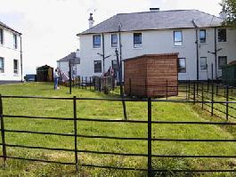
20/10/2020 - ongoing The nearby houses in Errol Place are no longer occupied and are scheduled for demolition in early 2021.
Aberdeen Information
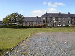
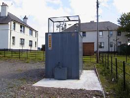
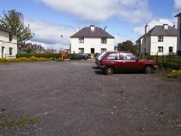
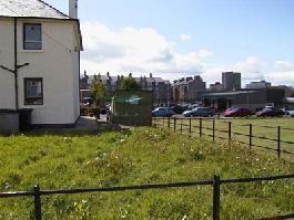
The monitoring station is within a self-contained, air conditioned housing located in an open area of ground within a housing development. The city centre is approximately 1 kilometre from the site and Aberdeen beach is around 500m away. The nearest main road, the A956, is 70m away.
UK-AIR ID: UKA00399
EU Site ID: GB0729A
Altitude (metres): 20
Environment Type: Urban Background
Site Location
Environment Type: Urban Background
Site Address: Aberdeen
Government Region: North East Scotland
Easting/Northing: 394396, 807392
Latitude/Longitude: 57.157360, -2.094278
The static map below shows where the monitoring site is located.
» View this location on Google Maps (new window)
Partners
The Partners who operate networks at this monitoring sites are shown in the table below. Clicking on the Partner name will open their website in a new window.
| Operator | Networks |
|---|---|
| Bureau Veritas | Automatic Urban Monitoring Network |
Pollutants measured at this monitoring site
The pollutants measured at this monitoring site, grouped by network, are shown below.
Automatic Urban Monitoring Network
| Pollutant | Start Date | End Date | Inlet Height (m) | Hourly PM Measurement method |
|---|---|---|---|---|
| Ozone | 01/08/2003 | 20/09/2021 | 2.6 | |
| Nitric oxide | 18/09/1999 | 20/09/2021 | 2.6 | |
| Nitrogen dioxide | 18/09/1999 | 20/09/2021 | 2.6 | |
| Nitrogen oxides as nitrogen dioxide | 18/09/1999 | 20/09/2021 | 2.6 | |
| Sulphur dioxide | 01/01/2001 | 30/09/2007 | Not available | |
| Carbon monoxide | 18/09/1999 | 30/09/2007 | Not available | |
| PM10 particulate matter (Hourly measured) | 18/09/1999 | 20/09/2021 | 2.6 | FIDAS200 |
| Non-volatile PM10 (Hourly measured) | 20/02/2009 | 07/11/2019 | 0.0 | |
| Volatile PM10 (Hourly measured) | 20/02/2009 | 07/11/2019 | 0.0 | |
| PM2.5 particulate matter (Hourly measured) | 20/02/2009 | 20/09/2021 | 2.6 | FIDAS200 |
| Non-volatile PM2.5 (Hourly measured) | 20/02/2009 | 07/11/2019 | 0.0 | |
| Volatile PM2.5 (Hourly measured) | 20/02/2009 | 07/11/2019 | 0.0 | |
| Modelled Wind Direction | 01/08/2010 | 20/09/2021 | Not available | |
| Modelled Wind Speed | 01/08/2010 | 20/09/2021 | Not available | |
| Modelled Temperature | 01/08/2010 | 20/09/2021 | Not available | |
| PM10 Ambient Temperature | 20/02/2009 | 07/11/2019 | Not available | |
| PM10 Ambient pressure measured | 20/02/2009 | 07/11/2019 | Not available | |
| PM2.5 Ambient Temperature | 20/02/2009 | 07/11/2019 | Not available | |
| PM2.5 Ambient Preasure | 20/02/2009 | 07/11/2019 | Not available |
Networks measured at this monitoring site
The listing below shows the networks that this monitoring site belongs to. You can search for sites within these networks by clicking on their name, or use the network information links to find out more about them.
| Network | Search | Further Details | Get Data |
|---|---|---|---|
| Automatic Urban and Rural Monitoring Network (AURN) | Automatic Urban and Rural Monitoring Network (AURN) | About network | Latest pollution summary Current Levels Pre-Formatted Data Files |